July 26 – August 4, 2018, East to West
Foreword
I decided to take up backpacking last year, in March of 2017. During my hiking trail research, I focused on two places: the Appalachian Trail 100 Mile Wilderness in Maine and the Canol Heritage Trail in Canada’s Northwest Territories.
I was drawn to the Appalachian Trail since my family took some day trips there when I was a child. I researched section hiking and decided on the 100 Mile Wilderness because it is the longest section without resupply (the most remote). It is very rugged and there are many streams with brook trout for fishing.
The Canol Heritage Trail grabbed my attention because it is exceptionally remote and rugged, has beautiful scenery and takes one very far away from civilization. Also, it is considered the most difficult trail in Canada, and probably all of North America.
I hiked the 100 Mile Wilderness two times last year, and I hiked it 1.5 times just prior to flying to Norman Wells to tackle the Canol. 1.5 means I repeated the most rugged part, the forty-three miles at the beginning (PUDs or Pointless Ups and Downs, and nine of the ten major mountains), just to test out my new Hyperlite pack and Salomon XA Elevate Trail Runners. I hiked these forty-three miles in two days, confirming to myself I could do 20+ miles in rugged terrain with the new equipment.
At the last minute, based upon this recent equipment test, I decided I needed more calories for the Canol. I added an extra Clif protein bar and Monster Slim Jim per day to the food (bringing them from Maine, to add to the supplies I already shipped c/o Canoe North Adventures in Norman Wells). The additional food added 540 more calories per day, and more weight to the load I would carry in my backpack. I reviewed my equipment again and made some tough reductions, including removing my 0.5-pound raincoat. I had already removed my camp shoes and cook system. Funny thing, I should have removed my headlamp because it never really achieves full darkness on the Canol on the days I would hike.
Norman Wells
I arrive at Norman Wells to the sight of beautiful mountains, arctic/alpine stunted pine trees and the mighty Mackenzie River. It is hot today, maybe 85F. It will be the same tomorrow for the first day of hiking, then it will cool off. The forecast says it will possibly rain in four days, on Sunday morning.
I need to schedule North-Wright Airways to pick me up at the end of the trail. I’m lucky. There is a North-Wright Air employee at baggage claim who asks me if I’m going to North-Wright. I tell her I need a return flight from mile 222. She tells me to go outside and turn right, and a little way down I’ll find the office to schedule the pick-up. Lucky because I’d been planning to schedule the flight at the North-Wright office next to Canoe North Adventures where I’ll be spending the night, and I wasn’t aware there’s no administration there. I would have been taking a taxi ride back to the airport to schedule my flight.
I start walking down the road and a pickup truck stops. The guy inside kindly asks where I’m going, and I tell him. “Get in,” he says. Everyone in Norman Wells is friendly. With only about 800 people, everyone knows everyone. They are also living at the last frontier, and maybe they have a happier life view than those back home nestled in their insulated antiseptic world.
Mr. Friendly drops me off at North-Wright Air, and I go in and find the guy to schedule my pickup, Dennis. It’s C$3100 to pick me up in a Cessna at the small grass airstrip at the trail’s end. Dennis needs an actual expected pickup date so he can schedule the plane, and I tell him the 6th of August, which is twelve days from tomorrow. I can text to change if I won’t be on time. I text the company cell phone to establish communication through my Garmin inReach Explorer, and we confirm it works.
I also ask about doing a food drop. I have twenty-four pounds of food, and my pack will be forty-three pounds if I carry it all. I can go much faster if my pack weight is thirty-one pounds. I can have half the food dropped at mile 80. It’s not possible to do it at the halfway point at mile 111 because there is no place to land. They’ll have to use a special plane to drop at 80, I think he says a Twin Otter. Unfortunately, this will cost C$2900, so I decide I’ll carry the extra twelve pounds from the beginning.
As we talk, I tell Dennis I’m looking for a boat ride across the Mackenzie River in the morning, and he knows a guy who can do that. He leaves a message with my phone number for James at Sahtu Adventures.
The North-Wright employee at the airport had given me a taxi business card and I call for a ride to Canoe North. A very friendly, talkative guy picks me up. I have previously informed the taxi company I need to make two stops, one for bear spray and one for cigarettes.
We go to the one store that will have bear spray. On the way, the driver tells me someone drowned in the Mackenzie this last week. The store has many things, but they have sold all the bear spray to the search and rescue teams that were looking for the drowned man. The shop owner calls “The North Store” to see if they have any and is told no. He then calls the search and rescue team leader to see if he can buy one back, but they’ve all been distributed out. Nice of the owner to go to such lengths to try to get me one. I’m hoping Canoe North will have one, and I’m nervous about going without. I hear that only black bears are on this side of the river and bear spray isn’t needed. It’s vague if it is needed for the grizzlies on the other side.
Next, to the store for cigarettes. I hadn’t considered they wouldn’t have Marlboro Ultra Lights, but they only have Canadian cigarettes. The lady doesn’t know cigarettes, and I decide on Players. (They aren’t very good, so they’ll be the reserve if I run out of the good stuff.)
The driver gets a text and asks if I would mind if he picks up some guys on the way and drops them off at the airport. I’ve got time and it sounds like fun, so I say I don’t mind at all. He pulls onto the main wharf on the river, which is a basic jetty and a lot of dirt. We pick up four guys who have been working there. We chat, telling each other about ourselves. One of the guys hears I couldn’t get bear spray and he says maybe he has one. He looks in his truck’s glove compartment and finds a new bear spray still in the package. He gives it to me, refusing my attempts to pay for it. He says, “It was C$37.95, this is my Good Samaritan act for the day.”
I’m relieved and amazed at how nice a thing he has done. We drop the guys off at the airport and the taxi only takes cash or debit, no credit. The guys don’t have it, so I get my chance to repay the bear spray kindness and pay their bill with cash.
The driver gets another text and asks if I would mind one more pick up and drop off at the airport. I’m happy to see what other kind of people he will give a ride to and say, “No problem.” The pick-up place is a house, and a young girl and an attractive middle-aged woman get in. They and the taxi driver know each other. The woman is flying out and the girl is going along for company. The woman banters with the driver. I think she likes him. We drop them off and now I get to Canoe North Adventures.
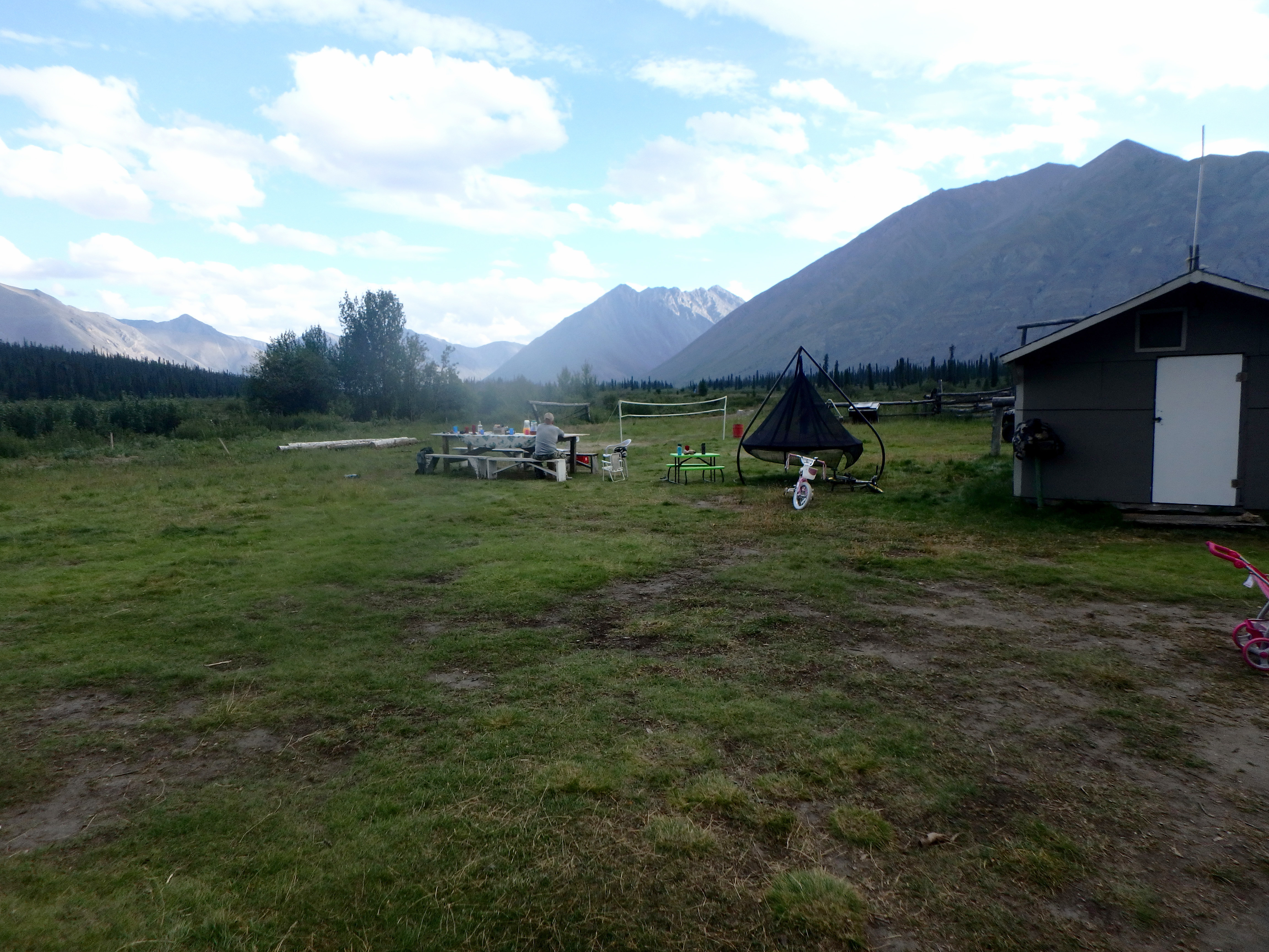
There is an awesome cabin, racks of canoes, four outside “tent cabins” and a beautiful view over the aviation lake out of which North-Wright operates float planes. There is also an outbuilding and two shipping containers with lots of supplies. Canoeists don’t need to worry about weight like backpackers do. They carry a heavy, happy hour barrel of drinks with them. They bring lots of good food and they catch and cook fish, too. They pack two Twin Otters, each with three canoes, supplies and six people, including one guide in each. They fly 500 miles away and then canoe back to 100 miles away. Sounds so awesome, I vow to try it someday.
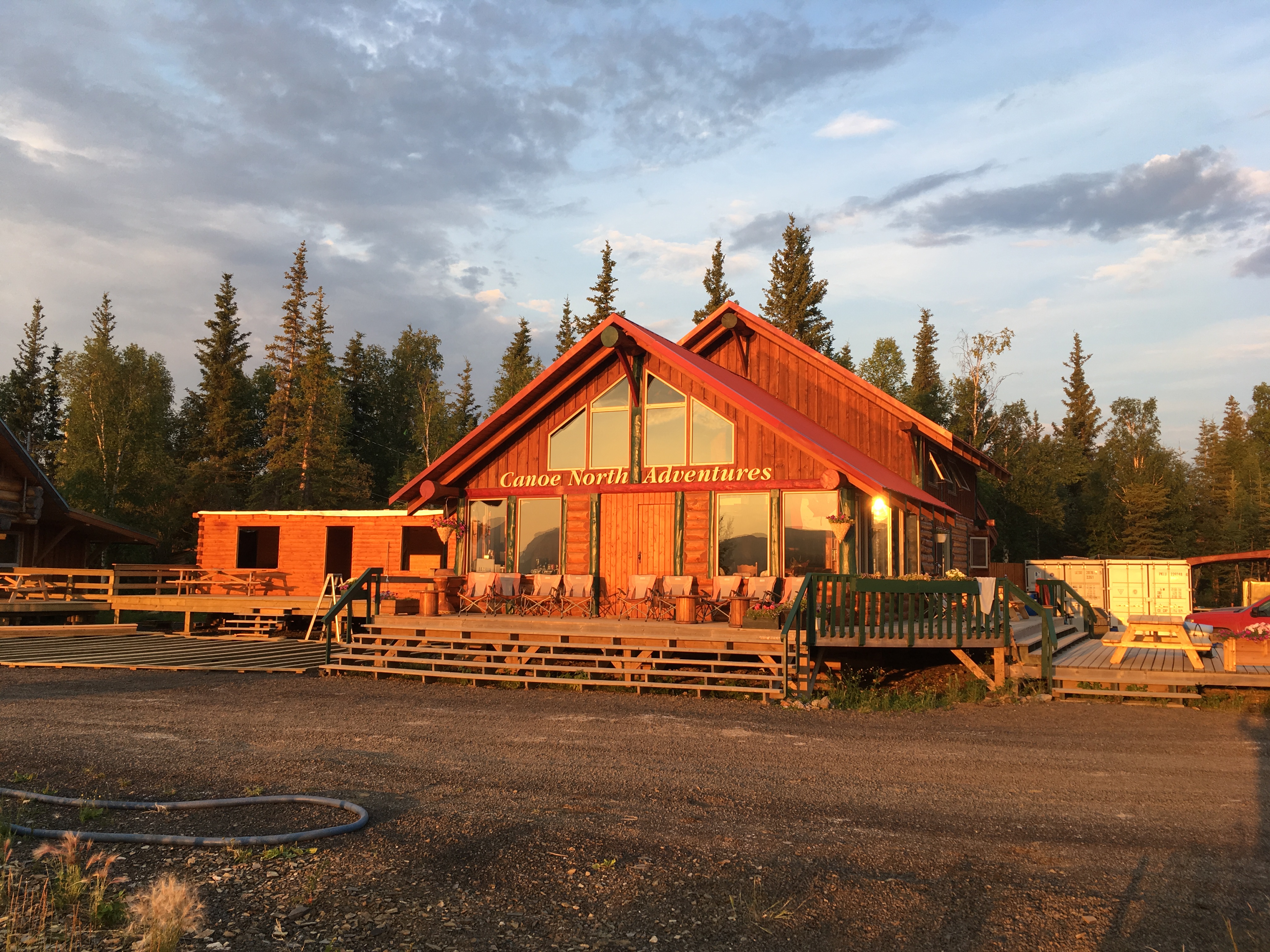
I’m greeted with the good news that the food, stove fuel and airhorn I shipped ahead of time have arrived safely. I’ve decided to go without my cook system, so I give the MSR fuel canister to one of the canoe guides.
I chat with canoe guide Matt, who has hiked some sections of the Canol. After I tell him my fire-starting system will be the cardboard from cigarette packs, he digs around in the supplies and gives me a brick of some white fire starter material and two little brown colored fire starter bricks. They don’t weigh much.
James, the guy with the boat from Sahtu Adventures, calls. He agrees to pick me up at Canoe North Adventures at 8:00am tomorrow and will boat me across the river to the trailhead for C$80. Seems very reasonable. Of course, I’ve recently been seriously contemplating the ridiculous idea of paying C$2900 to transport twelve pounds of food.
In the early evening, the staff is going to dinner and they invite me along. I’m adopted by the group since I’m the only guest today. This seems to be the first time Canoe North has had a backpacker stay the night. It’s an aberration for them, but they are friendly and kind. The restaurant has excellent wings, and everyone but me drinks alcohol. I decline, mentioning I need to be sharp in the morning.
I’m out at the restaurant smoking area and one of the cooks shows up. He has hiked the trail and gives some info about his experience. Another guy talks about the excessive numbers of bugs and the need to tape one’s pants at the ankles to keep mosquitoes from getting in. I go back inside and watch the Canoe North people play darts. I talk to a couple and ask them if they’ve seen the two angry men in the Canadian flag? They haven’t. Soon, the whole group is peering at their country’s flag, and most see the two men.
Back at Canoe North, I ask about, and receive, a big bowl of chocolate ice cream. Tastes especially good since I won’t have any luxuries for a while, starting tomorrow morning. I talk to Keiran, one of the senior guides, and he suggests I might like the Stein trail. I’ll check it out.
They know I get up early, so before bed, I receive instruction on how to make coffee in the morning.
Day 1: Thursday, July 26, To the Carcajou River, Mile 23 (23.0 miles)
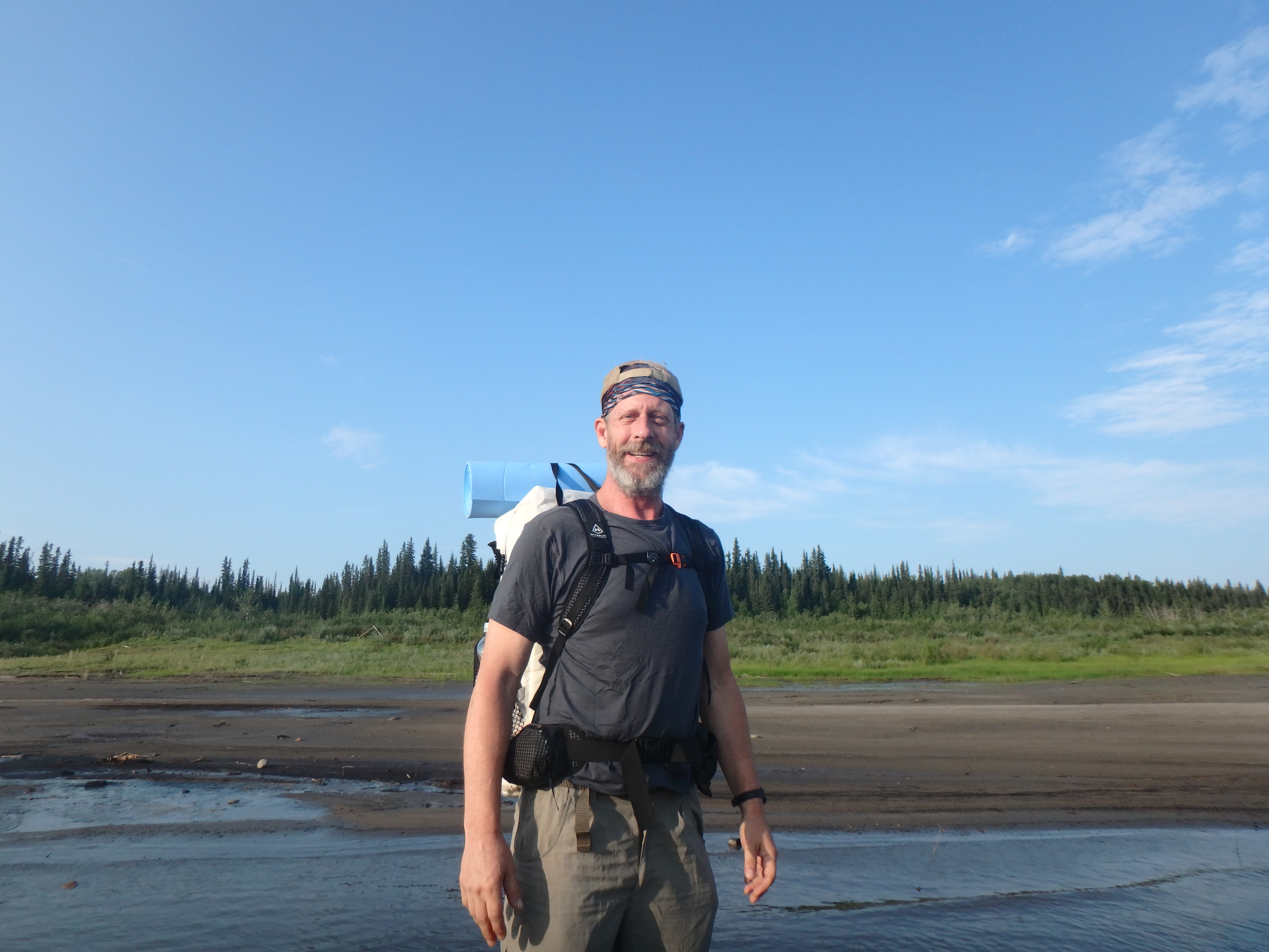
I’m up and getting ready early. I realize I can’t remember where I packed my head bug net. I unpack and find it in my clothes stuff sack and move it to the external pack mesh pocket for easy access. Bears and bugs, OK. Now, my foremost concern is the forty-three pounds I’ll be carrying on my back. Will it slow me down too much? I’m ready to find out.
I take a shower, my last for a while. I pack up all the stuff I’m leaving behind except the cell phone. I text friends and family back home that I’m on schedule to begin the hike. I consider exchanging my beat-up AgriGold ball cap for a new Canoe North Adventures hat, but decide it’s better not to change any of the system at the last minute. Just before 8:00, I turn off the cell phone and stow it with my wallet and other gear which will be staying behind in the care of Canoe North.
James picks me up in his truck, towing his boat. We arrive at the same dirt jetty where we picked up the four guys yesterday (one of whom gave me the bear spray). James backs the boat into the water and we get aboard. The boat is fast. Partway across the river, James asks if I mind if he smokes, and I say, “Only if I can’t smoke too.” I guess I don’t look like a smoker because he does a small double take. We both enjoy our cigarettes.
I’m pumped with anticipation. I have surprisingly little apprehension. I’ve researched the Canol extensively, but I’m still too ignorant to have the correct amount of trepidation. I’m a “jump in and find out what happens” kind of guy. My equipment and food are well planned and tested. I have a second, fully charged spare camera battery, so I won’t have the problem I just experienced in the 100 Mile Wilderness where the battery ran out three days before the end, with no spare.
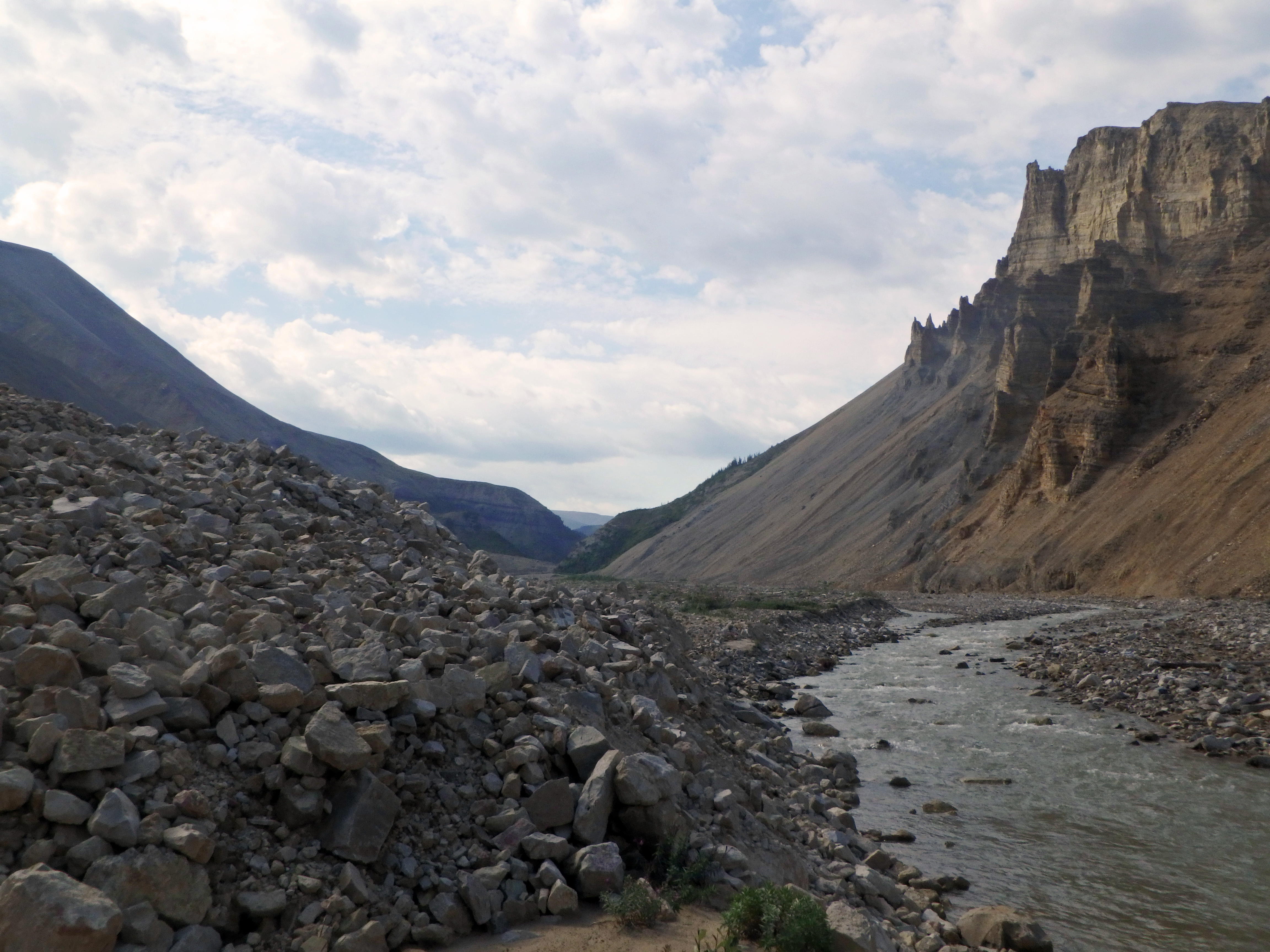
James calls a friend for advice on exactly how far up or downstream to drop me off to be able to get as close to shore as possible, and he’s told, right at the trailhead. As we approach, James points out the big white sign we can see from a few hundred yards out. “It’s the mark of the start of the trail,” he says over the wind of the boat’s passage.
As we pull up to the shore, he gets us to knee-deep water. I pay him C$80 for the ride, grab my pack, and get on the bow to jump in. James asks, “Aren’t you going to take off your shoes, first?” “No,” I tell him as I jump in, “I like wet feet.”
It is 8:35 am. I turn around and thank James and give the boat a push back out into the river. I wave as I head to the trailhead. I can’t see the sign anymore, so I decide to head to the left of a small ravine. James has been watching from a hundred yards away and yells, “More to the right.” I follow his gestures, disappear into the tall undergrowth, and find the sign.
I put bug spray on my arms, face and neck, sparingly, because it is unclear how much I will need for the whole trail. I take a picture at the sign, and I’m ready to begin the hike. Trails go both right and left from the sign, but the one to the right is more pronounced, so I take it. It’s the correct choice.
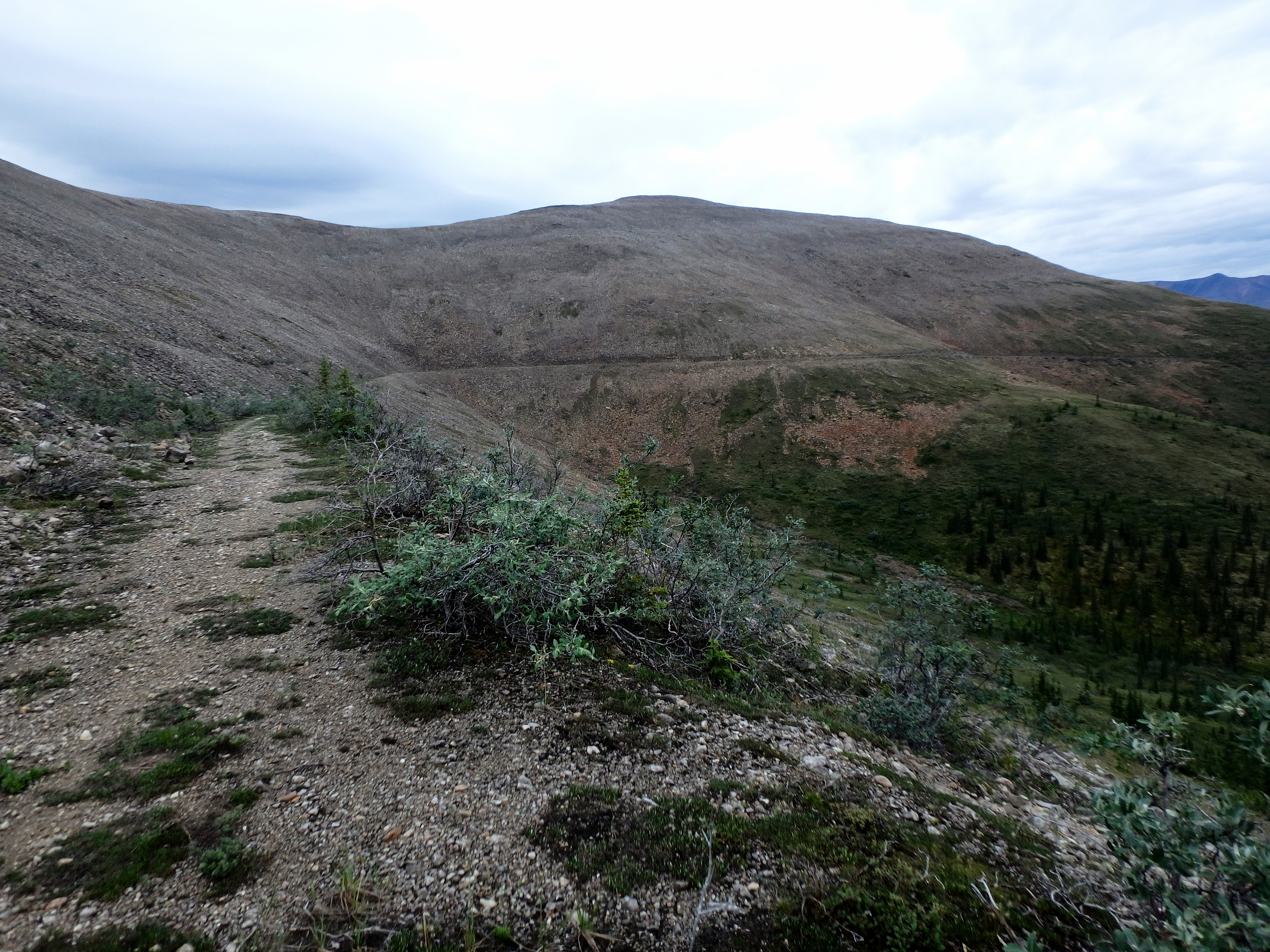
Today I hike miles of well-delineated trail. There are many mosquitos and small black flies. I wear the head bug net to cover my ears but not my face. If I keep moving, the mosquitoes can’t get at my face. Bugs try to attack my ears constantly whether I’m moving or not, and the net keeps them away. The one guy yesterday told me I’d want to tape the pants of my trousers to keep the mosquitos out. I didn’t and it isn’t a problem, possibly because my Rail Rider Eco-mesh pants are impregnated with permethrin.
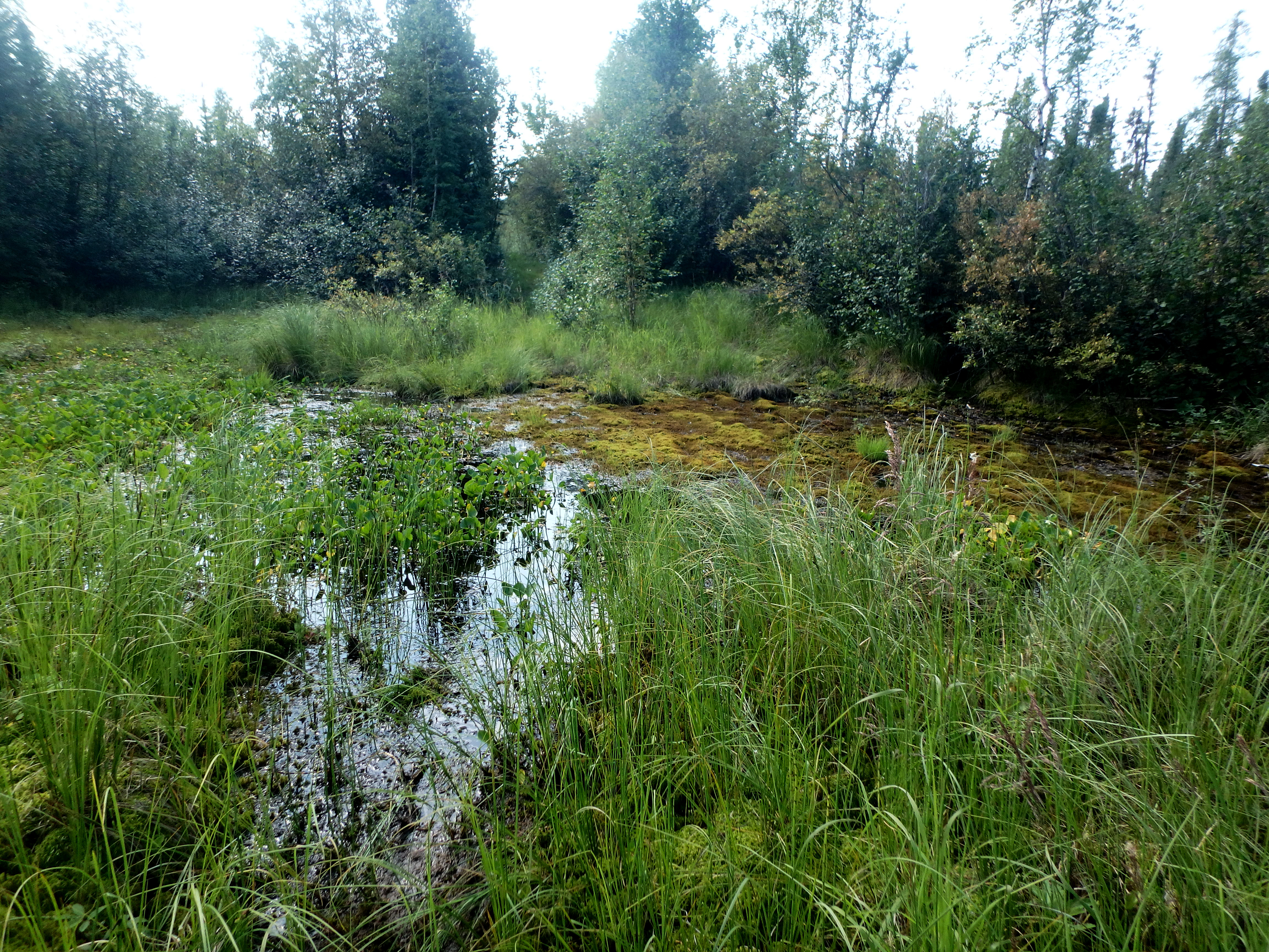
I hike through many bogs. There are no bog bridges like there are on the Appalachian trail. I must wade through these. I encounter countless mud troughs, marshes, streams and puddles to hike across. I come to where a beaver has built a dam right on the left side, obliterating the trail. I wade next to it and sometimes step on the dam when the water is too deep. Today is generally a minor uphill slope to the base of the Mackenzie Mountain range. The streams are small and easy to ford.
I occasionally stop for a rest with a cigarette and sometimes with a Clif bar. I’m keeping two sandwich baggies in my left pants pocket. One baggie has my cigarettes and the other is for spent, field-stripped butts. For some reason, the cigarette pack isn’t in the baggie when I ford a shallow puddle which turns out to be more than waist deep. The mostly full pack is ruined.
I have an air horn in my right pocket for scaring off bears, and fortunately, a bear spray in the left pack pocket where I can easily “bring it to bear” should the air horn not be deterrent enough. At 6:29pm, I look up and see a black bear on the trail 150 feet ahead. I yell a startled “Hey,” and grab for the air horn and bear spray (I momentarily consider getting the camera first, but reason wins out). The bear takes a backward look at me and runs away through a hole in the foliage to the left. I carry the horn and spray in my hands for a little while, and then put them back where they came from.
At about twenty-two miles, I come to a couple of shacks next to the Carcajou River. I can’t see the trail continuation across this small section of river braid. I check out the shacks and notice what appears to be the trail continuing up the river. I follow it a few hundred yards and realize it probably isn’t the Canol. I decide to cross the Carcajou here and worry about connecting to the trail on the other side.
I find a place where the river splits into two branches. It is thigh high and swift. I’m careful and make it to the split. From the land in the split, I walk down a little and cross the other half easily. I see a path that looks like I might miraculously have landed exactly where the trail continues. Some sand on the bank looks soft for a bed, so I set up the tent for the night at 8:40 pm. A good day. I’ve done twenty-three miles. I fish but get no strikes.
I have no idea I am lost.

Day 2: Friday, July 27, To the End of Dodo Canyon, Mile 39.5 (16.5 miles)
I wake up, smoke, and eat my Clif bar breakfast. I put a Clif bar in the left pack hip pocket with the camera, spare battery and swiss army knife. I put one protein Clif bar in the right hip pocket with the sunscreen, Aquamira (water purification drops), Body Glide (Anti-chafing stick for my feet to avoid blisters), fishing lures and Off. Lastly, I put one Monster Slim Jim into the mesh side pocket of the pack. The two Clif bars and Slim Jim will be for morning snacks. This will be my morning routine every day, except henceforth, I will add a cold cup of instant coffee while I smoke after waking up. As usual for backpacking, smoking will be my security blanket, reward system, and idle time filler. I smoke cigarettes only in the evenings after 5:00pm back home. On the Canol, I will smoke all day, forty a day. I pack up and am ready to go at 4:30 am.
I go to the apparent trail and head down it. It is quickly clear it isn’t the trail.
I study my paper maps. The trail should continue across from where it stopped, and skirt the base of a hill into the canyon. The elevation scale of the map does not give enough detail to see which of these first small hills is the one I need to go to the right of. I’m guessing the one a little in front and to the left, so I head in that direction, searching.
There is no sign of the trail, so I pull up the map on my Garmin inReach Explorer. There are two tracks on the Explorer. One is white, and it comes preloaded with the Garmin map and marks parts, but not all, of the Canol Road. The white track stops at the Carcajou River, and there is no white track showing the entry to Dodo Canyon.
The other track is red and is an approximate trace of the Canol Road I entered manually and synced to my device. The red track is aligned in places to a dotted line marking the trail on the Garmin online website map. It is not clear if this is the same as the white track I see on the inReach screen. The dotted line on the Garmin website map also has significant gaps of missing trail, and, in these places, I aligned the red track semi-loosely to the paper maps.
The inReach zooms in enough, I can see the white and red tracks at the same time in most places. Since there is no white track here, I start toward the red track, to the west. The red track is significantly west of my Carcajou crossing spot because I followed the “not-the-Canol-Road” upriver last evening.
I make my way through varying amounts of trees, shrubs and tundra. In places the tundra is solid and easy to hike, in others it is spongy and takes more leg power. Sometimes the bushes and trees get choked and I bull my way through, or skirt to an easier way. I check to see that I have reached the red track, and I have. But there is no trail.
I wish I had understood better what I was doing when I set up the red track. I thought it was in the right place, or at least close enough. The reality is, there is exactly one place the actual trail is. Most places off the trail are much more difficult hiking because of spongy tundra and/or scattered rock scree and/or bushes and trees (and other obstacles like bogs, mud slides, cliffs, ice and streams). My red track into Dodo Canyon is not marking the trail, it is marking a useless estimate.
As I continue west, I’m watching the hill in front of me, thinking the trail will be found hugging it to the right. I expect it to pass through a valley into Dodo Canyon. However, I’ve already passed my red track to the west about a quarter mile. I know the track will lead me to Dodo Canyon, and I still suspect the real trail is farther west. The red line is falsely comforting, though, and I decide to climb the steep hill in front of me, staying parallel to the red track.
It is a wild and spongy place with trees and brush. I get to the top and hear a stream through the forest down the next valley. Maybe that is Dodo Canyon, so I decide to head down to the water sound. I look right and there is an open area with some sunlight, maybe a half mile to the southwest. It looks like what one would expect Dodo Canyon to look like and I’m pretty sure it is Dodo Canyon. The valley below is choked with trees and I conclude it is not Dodo.
I head down the steep hill and reach a small stream that I think should empty into Dodo Canyon. I follow the creek downstream. A sheer wall emerges on the right side, preventing me from continuing on dry land. I step into the water under the tight canopy of brush, and wend my way directly down the stream, bulling my way out of clogged brush at the end … right into Dodo Canyon.
It’s wide and open at this point with shallow fields of stream rocks and bands of scrub brush. I look back at where I came from. It is a wall of green plants with a thirty-foot rock face to the left. I chuckle to myself, tickled I managed to get so lost and still find myself.
The red track on the Garmin clearly runs down this wide valley, confirming this is Dodo Canyon. Should I look for the actual trail, or should I just continue down the canyon wherever I like? I decide on wherever I like. A small creek runs down the canyon, meandering back and forth, and I cross it occasionally. I head down the valley, taking in the beauty and enjoying this small crystal-clear stream flowing amongst all the rounded stream-worn rocks of this expansive canyon floor.
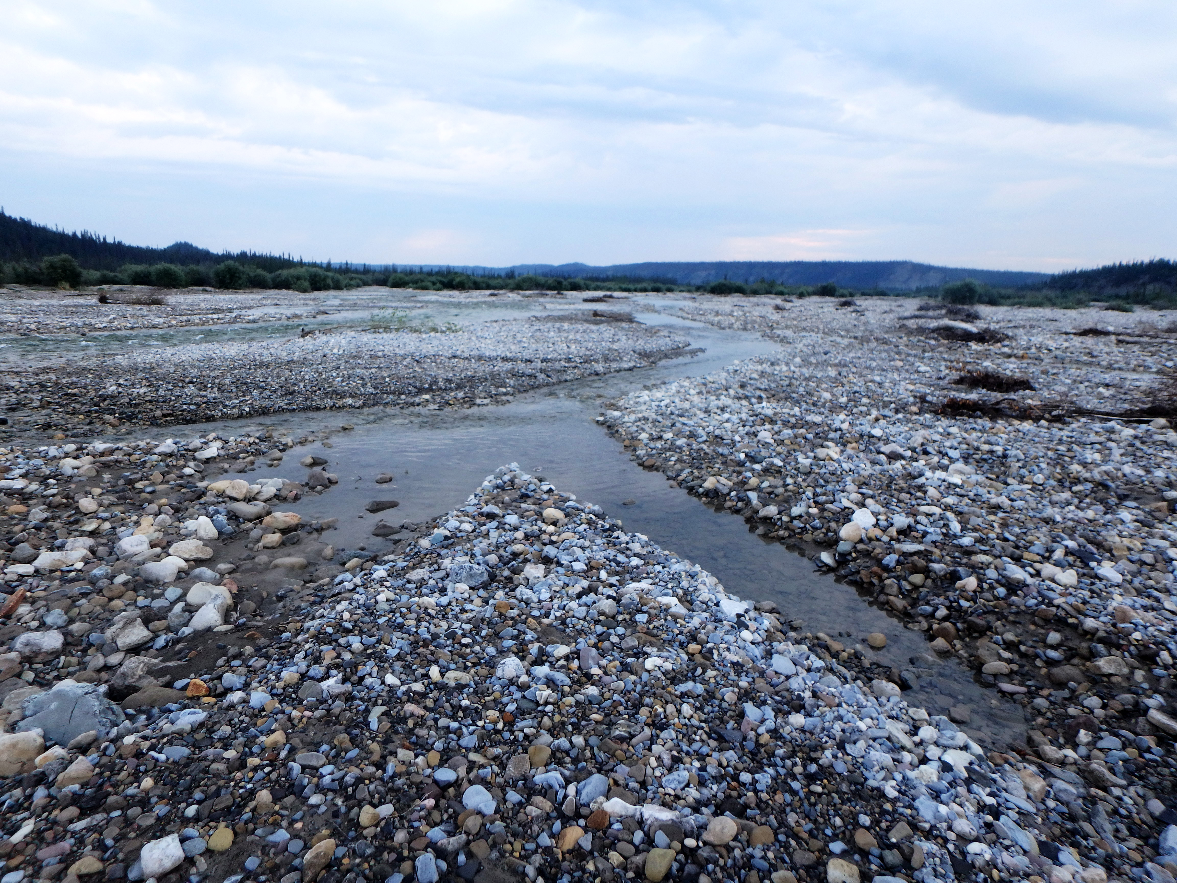
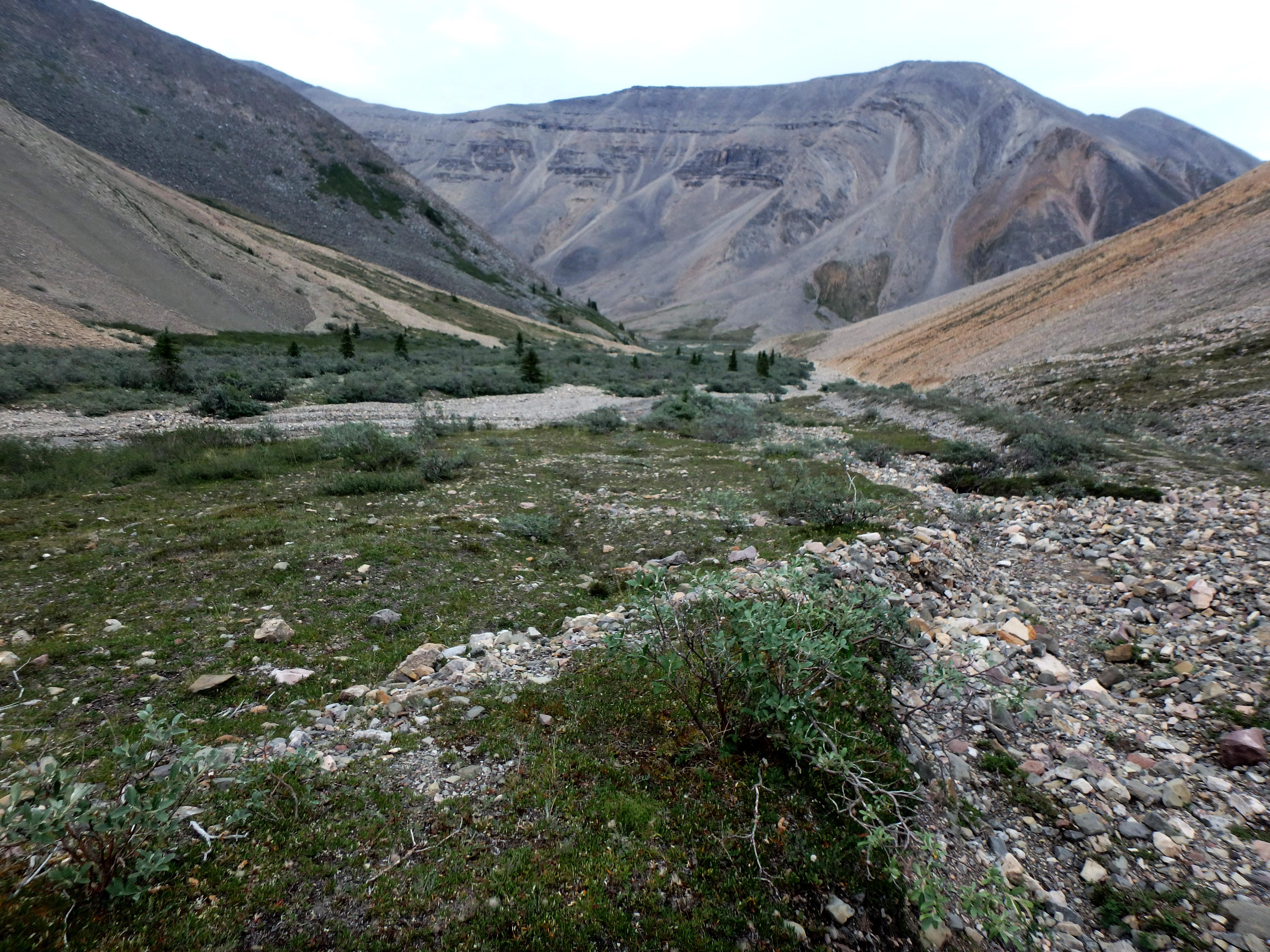
The way becomes rockier and eventually I am confronted with a narrower portion of the canyon that is all stream rock scree. Maybe the trail is here, but I don’t really know what to look for and everything seems to be water-worn rocks from canyon wall to canyon wall. The rocks are thrown into random bands of different sizes, making each step an effort in momentum. Rounded rocks slip back against the pressure of my foot, stealing my forward energy. Rock sizes vary, and I have to watch how I’m stepping. One- to four-foot-high ridges of rocks add an undulating difficulty to the hiking. The trekking poles are useless for adding forward force. Sometimes the bands of rocks are not stream-worn, but appear to be perhaps avalanche rocks. These are no easier to traverse.
This will be the warmest day, it is around 85F in the afternoon.
This arduous rock hiking seems to last forever. Maybe a mile into this nasty section of Dodo Canyon, I start thinking seriously of quitting. The place one can quit, without simply turning around, is at mile 80. I know this because that is where the food drop would have been. The other point is around mile 160. I calculate many times how long it will take me to leave the trail at 80. I play a mental game. If I hike earnestly for one-half an hour, I can then stop and have two cigarettes. This keeps me slowly progressing. There is no alternative. I can’t just stop. At best, I still need to somehow hike 50 or so more miles of this hell.
Finally, at 1:40 pm, I reach the small lake spanning Dodo Canyon I have read about. I arrive just as four bikepackers are re-stowing their rafts after crossing the water. It is strange to see humans. I wasn’t expecting any. I’ve read that only six to eight people backpack the Canol every year. It’s not clear how many bikepackers.
We chat, and they say they expect to get to Norman Wells today. I can understand bikes doing the last twenty-two at high speed, but it’s not clear to me how they can do the next five miles quickly. It was a misery for me. They mention that there is a lot of good trail between the Carcajou and Dodo Canyon, which I tell them I missed. I tell them about the rocks, and they say it’s mostly not that bad from here to 222. Still some nasty sections, but smaller. They say I should be able to get some good mileage in many areas.
The four have taken five days to get here. Their original plan was to turn around at the Mackenzie River and return to 222, but they have decided to stop at just the one direction (they are too tired to return). They ask how I got across the Mackenzie River and I enthusiastically tell them about James. I let then take a cell phone picture of his card so they can call him for a ride when they get there. They tell me about some guy that wants to hike the trail without eating any food to prove it can be done. I think this is crazy and I say it out loud.
One guy notices we all have Hyperlite packs and he declares this meeting a Hyperlite convention.
After I tell them my plan is to swim, they point out where I can go up and over to get past the lake. After they depart, I try going up and around, but the other side seems too steep. I head back down. In case I lose my pack and it sinks, I attach the GPS to a belt loop so I’ll still have it for the SOS button. With some trepidation, I slip into the water at a sheer slate wall. My feet can touch, and I edge my way along, holding onto the slate. Suddenly the bottom drops out and I’m swimming. I yelp a little in surprise, but the pack is floating nicely. I swim to the next shore access and then slowly thread my way through choked pathways to get the remainder of the way around the lake.

Rocks look much better over here. I notice later that a little water got into the pack through a drainage port at the bottom, but it’s no problem. I continue hiking. The rocks are much better, but still difficult. I consider stopping at a small waterfall at 6:06pm, but I’m nowhere close to twenty miles, so I wearily trudge on.
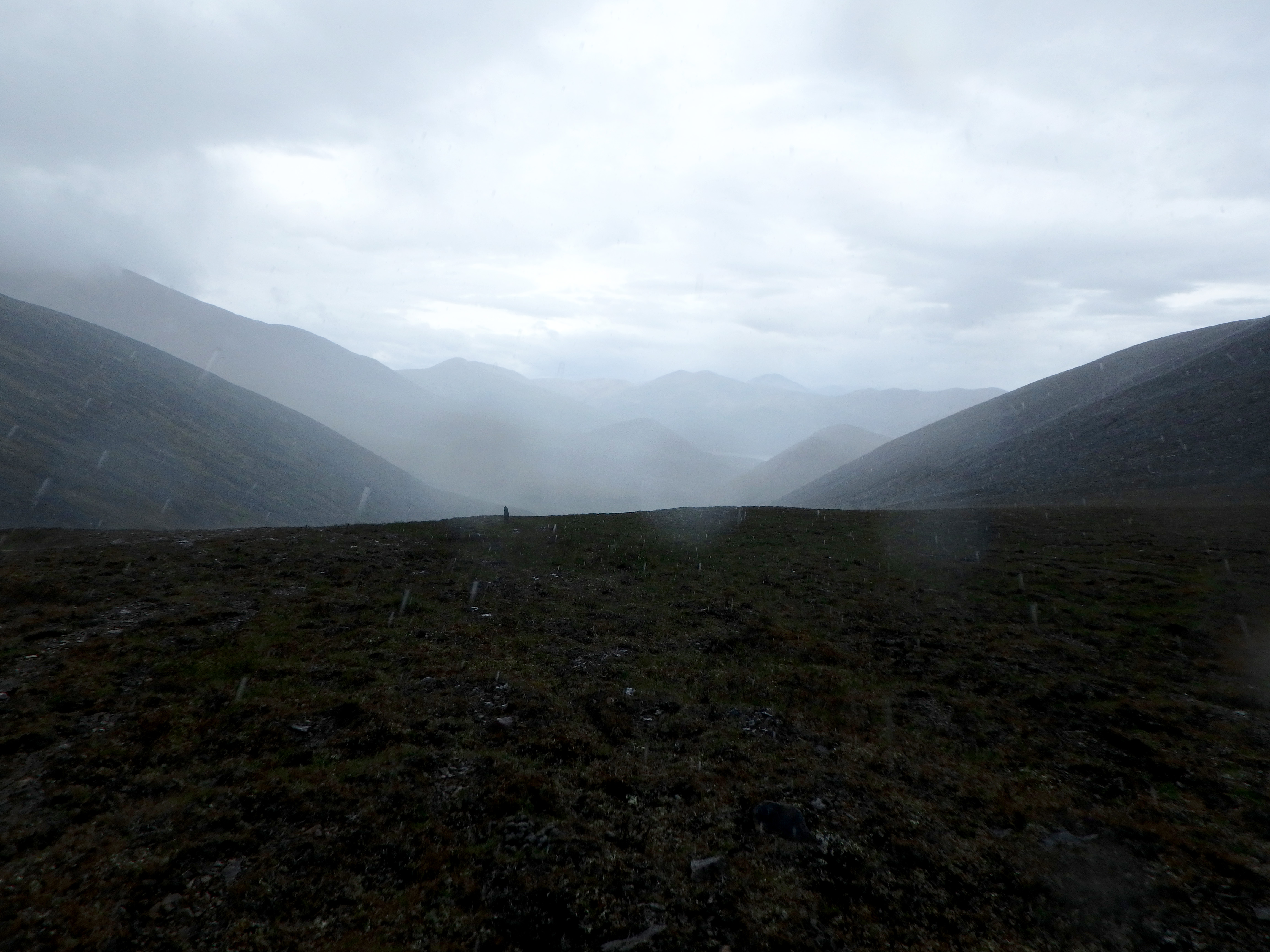
A few miles from Sugarloaf Mountain, the trail is noticeably easier, without all the rocks. It starts to rain at 7:40pm. I hastily set up my tent, throwing myself and my gear inside before it gets too wet. It thunderstorms heavily for about twenty minutes, then rains moderately for twenty-five minutes. It finally settles down to steady light rain.
I’m cozy in my warm tent. I’ve agreed with myself many times today that, for sure, I will exit this hiking hell at mile 80. Since I’m exiting the trail early, failing to make twenty miles today shouldn’t be a problem.
This trail is far too brutal. I want out.
Day 3: Saturday, July 28, To the Little Keele River, Mile 49.5 (10.0 miles)
I’m in better spirits this morning. Sugarloaf Mountain is coming up and I think it must be the big mountain ahead on the left. The trail should skirt its base straight ahead. I don’t realize that Sugarloaf is a much less impressive mountain on my left. I’m not really paying the correct attention to the paper map.
The trail becomes washed out, and I head to the right base of the big mountain through dense, stunted trees growing on a mossy forest floor. After a couple tenths of miles, including searching laterally, I can’t find the trail.
I pull up the GPS map. I discover this big mountain is not Sugarloaf. I head back to skirt the left side of this big mountain and soon find the trail again, going up the actual pass between Sugarloaf and this imposter.
I follow the trail up a valley. Sometimes it disappears, washed out. I pass a particularly tight section and see a valley up to a muddy area that must be the trail. My second mistake this morning. I have assumed the old road goes all the way up the valley, but it actually takes off to the right at some point, and I’m assuming it’s just washed out.
At the top of the valley, it’s all dirt and I climb steadily and enter what I christen “The Valley of Mud.” Water and dirt create a wide swath of stationary and moving dirt and mud. I hear clumps of wet soil break off and splat into the mud below. A step on a wrong patch and my left leg goes into squishy, sucky mud to the thigh. I have to pull three times on the leg to get it free. Fortunately, the suction is not enough to pull off my trail runner.

I make my way to the right around the mud bowl, staying high enough on the slope to be on stable, coagulated, drier mud. Nearing the valley genesis, I realize there is no way the trail would go up here. I look up the steep slope to the right and decide I need to get out of this mud hell. I clamber the steep slope to the top. I consult the Garmin Map and it tells me to keep going straight. Voila, I find the trail. Here it is as nice as it was back in the first twenty miles. I wonder if anyone else has been as stupid as me to slog directly up to the top of that mud valley.
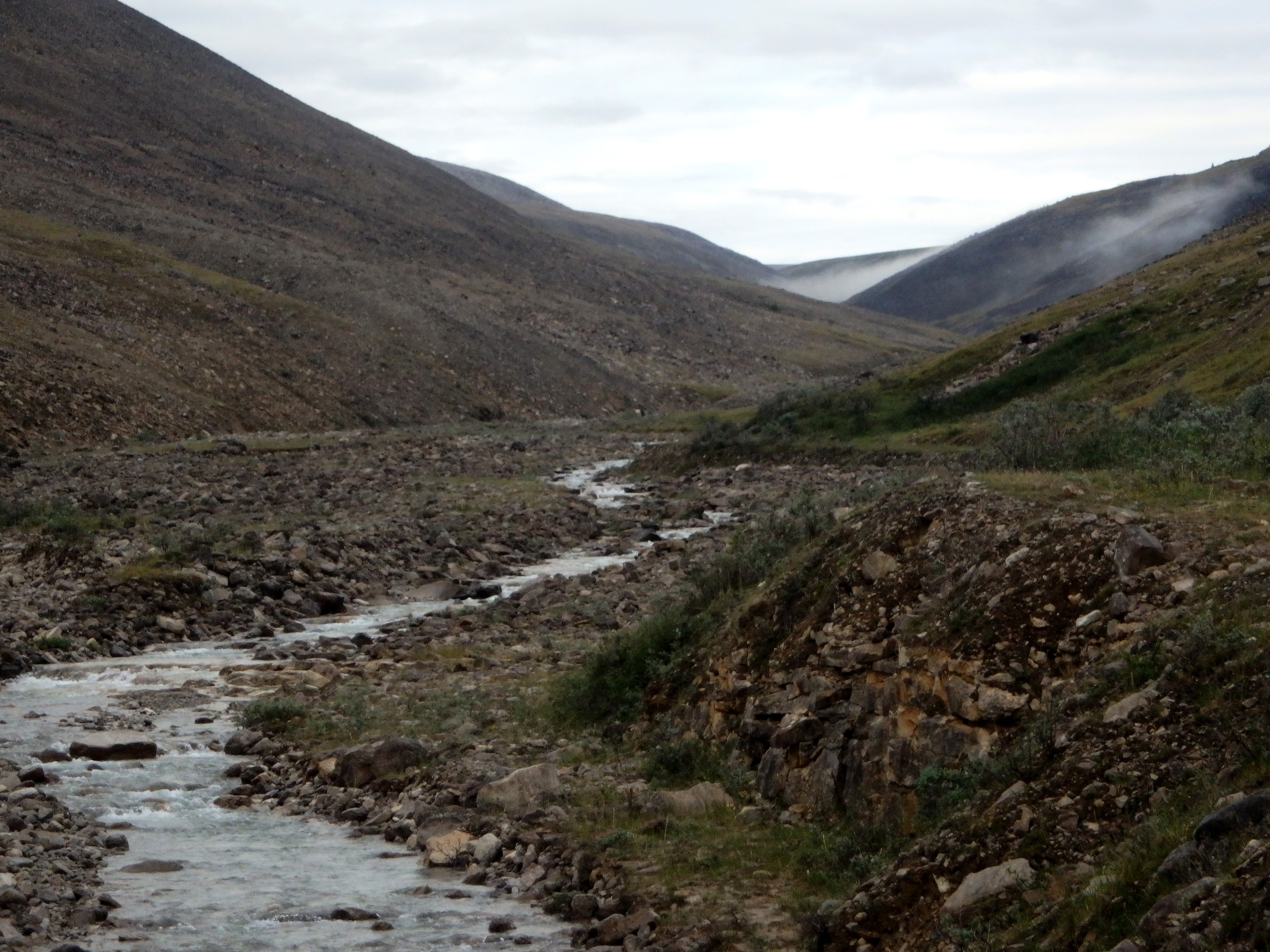
I arrive at Little Keele River at 12:09 and explore for a place to cross. The wider section ahead is over waist-high and looks angry. I’m sure I will get swept away down the rocky rapids if I risk it here, so I continue up the river on the north bank about a third of a mile to see if there is an easier crossing point. There is a place too deep to keep footing, but, in a pinch, I could launch across and swim out to the slower water on the other side. The second braid looks shallow enough to cross without swimming. The immediate swim looks a little dicey, though. The water is deep and fast.

I conclude the thunderstorm has made the river impassable and decide to wait for the water to, hopefully, recede. I pitch my tent near the trail discontinuation and place a rock at the stream’s edge to mark the present water level.
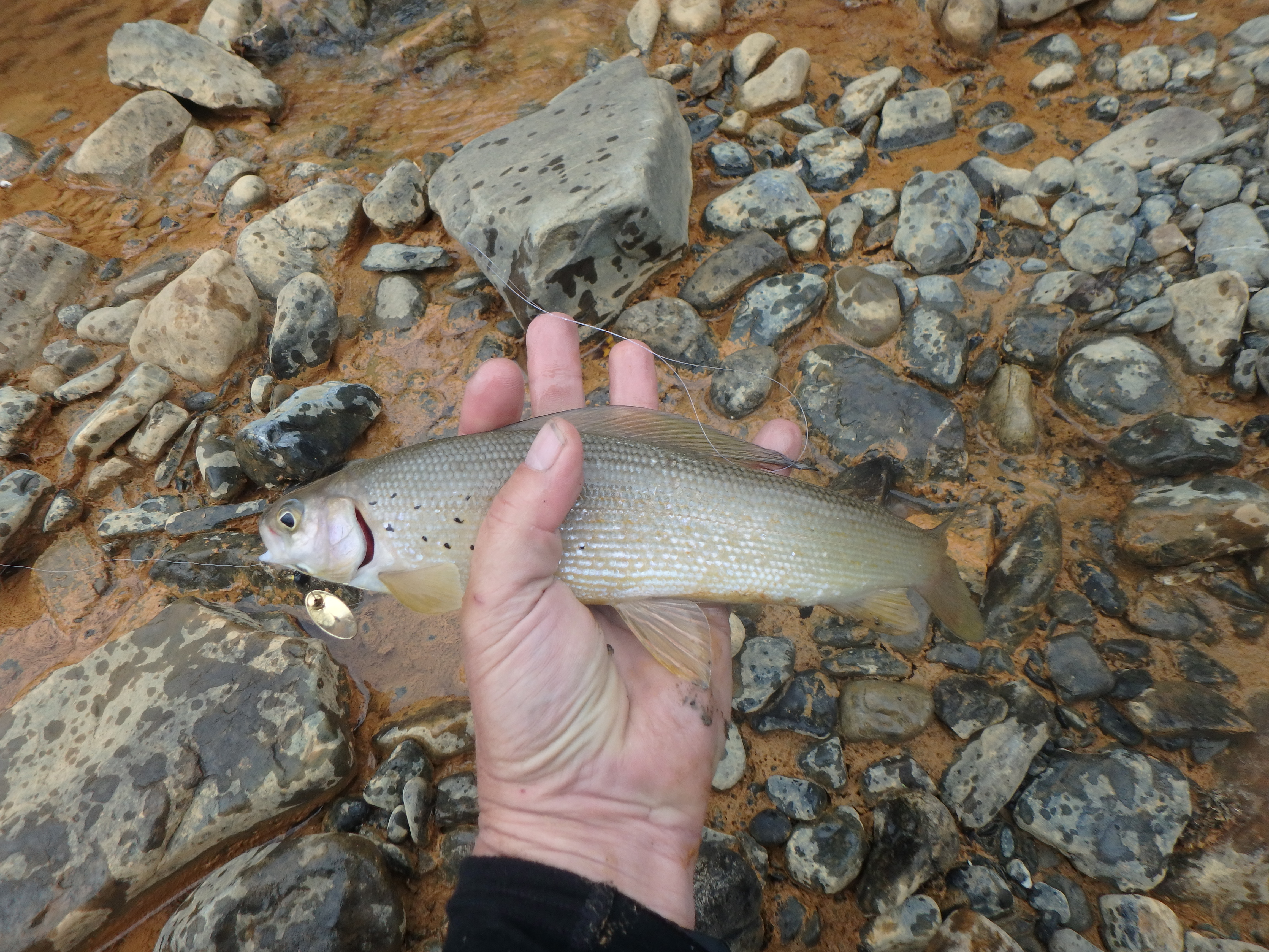
I set up my pole for fishing and cast into the awesome pools directly in front of my tent. I catch four arctic grayling, all six to seven inches long. They are fun fish and about the size I’m accustomed to with brook trout in Maine.
I don’t really want to go through the effort of cooking them. I’m more preoccupied with thinking about getting across the river. Death is on my mind. There is a possibility I will die while crossing since the water level right now will surely sweep me down the river through the rocks. I mentally accept this risk of death. Maybe I’ll get lucky and the water will recede significantly overnight.
I start a fire and heat up some chicken ramen noodles and eat. I go back to fishing and catch three more grayling. I head downstream a quarter mile checking out places to cross. There is a wide place that looks almost passable, though the far edge has a torrent about six feet wide that looks difficult. I classify this as option three for tomorrow morning. Option one will be the riffle area about 300 yards up from my tent, and option two, the place a third mile up that will require swimming.
I wonder how the hiker in 2016 died here. Did he get swept down the rocky rapids and hit his head on a rock, knocking him out? I contemplate the scenarios if I get swept up while crossing the riffle area. Do I swing to have my feet downstream and use my feet and poles to avoid rocks and to push constantly toward the far side? Do I turn so my pack is going first and cushions me from any rock hits?
The stone I placed to mark the water level looks like maybe it is an inch higher from the water when I go to bed. I had also mentally categorized the water level at three in-stream rocks but cannot tell any difference with them.
Day 4: Sunday, July 29, To the Turn to the Plains of Abraham, Mile 73.5 (24.0 miles)
I wake up nervous, but also determined to cross, even if I need to swim. I head over to my marker rock. It looks like the water is down several inches, maybe three. I still can’t see any difference at the other three reference rocks. After breakfast and a final cigarette, I’m packed and ready to go. First, I’ll check the riffle area. The forecast says rain this afternoon, so If I’m getting across, it needs to be now. If the riffle area looks too hairy, then I’m going to do the swim farther upstream.
I make my way to the riffle crossing spot. The water looks visibly lower and less raging. I start across without any delay. The first half to the quiet shallow middle is very doable, no higher than mid-thigh. The next section is more of a concern, and I start off with all the control I have. Halfway across this twenty-foot section, the water hits my crotch, but that is as high as it gets. I carefully set each step and pole, and… I’m across! It is 5:08 am. Elation, relief and a new confidence roll in.

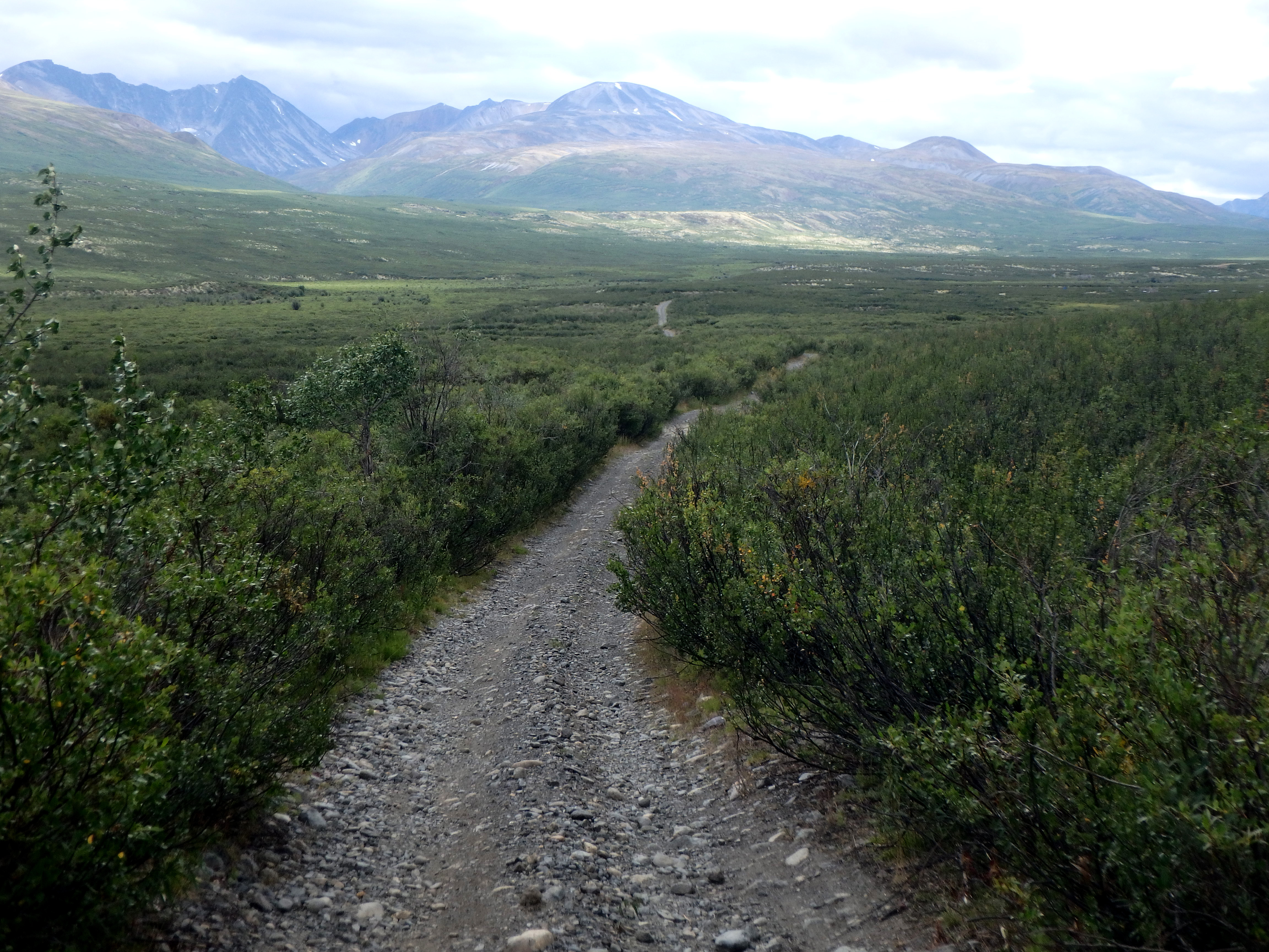
I consult the paper map and GPS and I know the trail will parallel the river downstream for a little while. The big question is, where is it? There is a large section of lightly forested higher ground ahead, and I scout straight up the river to see if I can find where the trail continues, but don’t see any sign of it. So, I climb up the small plateau and slog through the brush and tundra toward where it should be, and I find it.
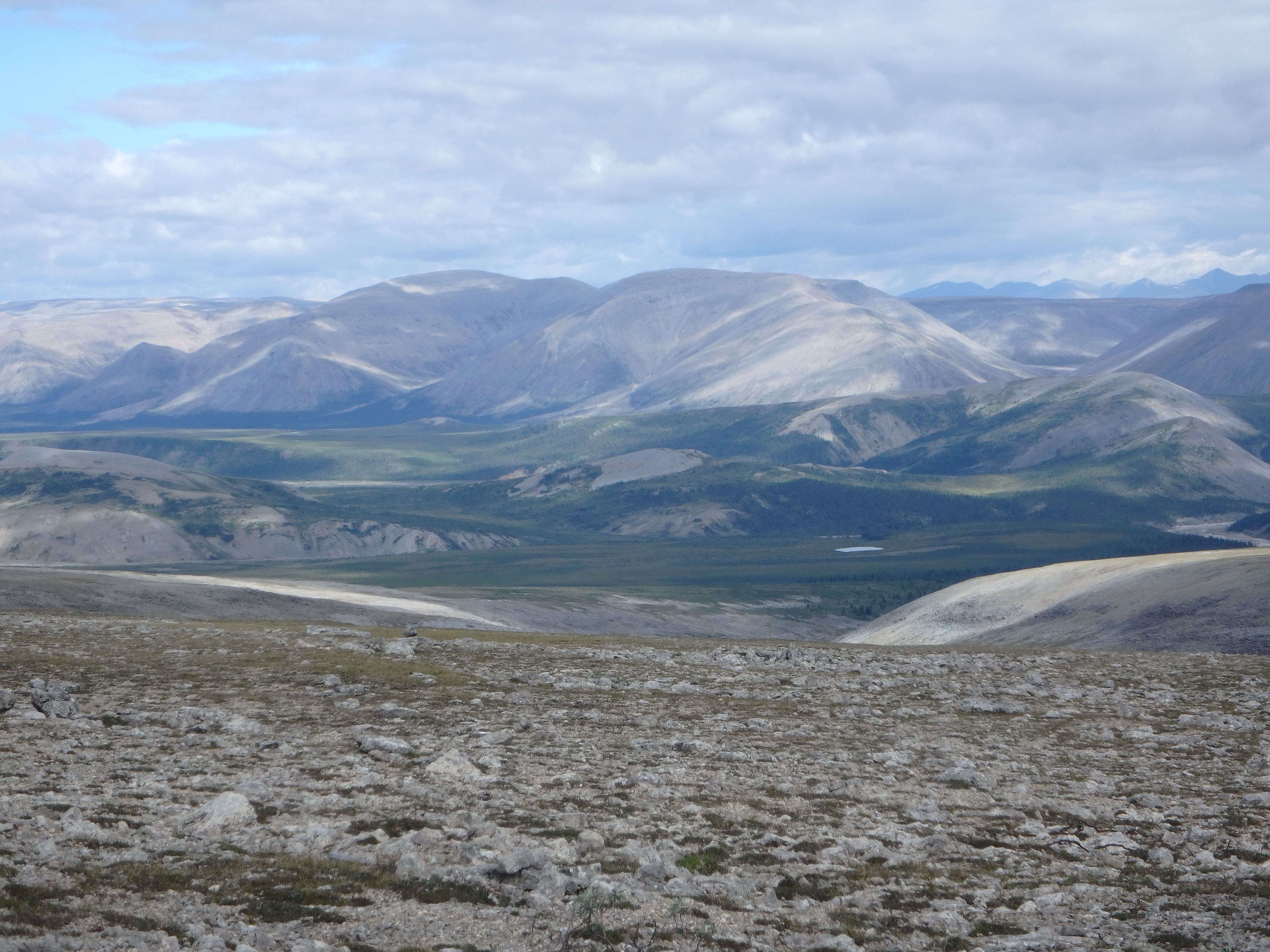
It is a nice, mostly no troublesome rocks, trail. I follow as it meanders away from the river and up a long gentle climb. It tops out with a spectacular view of a Fairytale Valley along an easy ridge trail that can be seen well into the distance.
This is the place I first encounter the strange and hilarious Ptarmigan. The Ptarmigan look like small chickens and they are nested by the side of the trail. When I approach, they either noisily flap off, the white parts of their wings flashing, or they skitter down the trail on their Speedy Gonzales legs, in both cases usually making a hilarious noise. I didn’t see Ptarmigan before, but I’ll see them for the duration from here. I wonder if I can get a license to hunt Ptarmigan. They look tasty and I could roast them over a fire.
The trail skirts the high side of the mountains, then winds down and back up. At 1:53, near the summit of this second climb, a flash thunderstorm comes and I choose to go through it rather than try to set up the tent. I’m soaked as if I had jumped into water. I’m a little worried about getting struck by lightning, but there is a higher peak maybe a half mile away, so I guess I, and my carbon fiber trekking poles, will be OK. It’s not overly cold, and I dry out quickly.
I continue hiking, and the trail comes back down toward an upper portion of the Little Keele River Valley. After a few hours of hiking this morning, and especially after rounding the corner and seeing the beautiful fairytale vista, thoughts of quitting at mile 80 have fully vanished. It truly isn’t all like the nasty sections of Dodo Canyon. Even what’s coming up ahead in the Little Keele River Valley won’t deter me.
As I enter the river valley at 3:38, the trail is completely washed out by a side tributary and rock slide material. The paper map and GPS both indicate the trail will follow to the left, upstream, partly up the slope. I head across squishy tundra that often turns into wet, boggy, squishy tundra. My feet have been wet more or less from day one, so I’m used to it.

There is no obvious trail, so I find the white track on the GPS and walk exactly to it. There is a line of stones and a bushy overgrown impassable area. I see small paths that make me think others have also searched here for the trail. I give up after one hour and twenty-nine minutes of searching, and head to the river valley to slog across marshy and stream-stony areas. It is very slow going in the actual river flat area. It’s clear the river shifts over time and over the last seventy years has reformed most of this river-bed area, leaving stones that are difficult to navigate. It’s bad, but it’s not Dodo!
After slogging a while, I look up to the left, at 6:07, and see the trail. It’s maybe a half mile up the very steep mountainside. Anything is better than this slow rock hell, so I cut off left and head to the trail at a point where it looks less steep. I’m slogging through squishy, wet tundra, which is slow going. Interspersed in the squishy mossy stuff are clumps of grass, maybe a foot high and ten to twelve inches in diameter. They are assured to be solid, but are tall enough, when you step on one, it bends one way or the other, robbing momentum. Not sure which is easier or faster, the spongy moss bubbles or the grass clumps. I use both.
I come across a stream and fill up with water. The extra weight is bad for climbing, but there might not be much water up there. As I continue up the tundra slope, it starts to rain. I hide under my blue sleeping mat for the little while it comes down. I finally arrive at the massive boulder scree base at 6:52 and start up. The steepness reminds me of Maine, and I’m careful to choose rocks that look firmly in place. I hit one that’s not, and my foot and the rock go into a crevice.
Fortunately, the rock is too small, and the gap is too large, to fully pin my leg, and I get it free. I mentally note I need to be more careful. Three quarters of the way up this steep rock scramble, I transition to some dry mossy tundra which supports my weight and gives good footing. I use some bushes to pull up the last part onto what turns out to be a beautiful part of trail, arriving at 7:14. Looks like climbing to it was the right decision. I start out happily and much faster.
After maybe three quarters of a mile, the trail just ends. I check the map. I check the GPS. I have been on a higher trail option above the main road. It should turn here where it ends and go down slope a little and join the primary road. I head down. I look carefully around, but I see no road. There is no main road. I decide I’ll have to slog the river-bed floor, and I start angling down the slope, using gravity and an angle to get some OK hiking in the direction I’m going before I suffer the rocky floor again.

On the rocks in the valley floor, I take on a determined attitude: I can do Dodo, I can do this. It is easier than Dodo. I slowly continue down the remaining miles toward where the trail will turn away from the valley up to the Plains of Abraham. I see an island stretch plateaued above the river-bed. I climb up. It looks like the Canol Road. I follow it a couple hundred feet and it ends, but there is another island ahead, in line. I do this several times. Seems maybe the road was here, but I thought the map showed it up the slope. This up and down fun ends and I just continue to labor the rock floor slowly.
I come up to the base of an interesting mountain that looks like a giant ant hill, and what looks like a “prairie” with some pine trees. I cross a stream and continue into this nice-looking non-rock area, and I find the trail. I continue to 10:53 pm until I’m close to the turn to the Plains and set up camp for the night, on the trail, next to a stand of pines. I’ve seen a wolf footprint close by, so I make a small fire just for the purpose of alerting animals that I am here.
A difficult day, but I’ve crossed the Little Keele River and made more than twenty miles. I have no more thoughts at all about quitting. It’s not easy, but I can do this.
Back in Norman Wells, when people found out I was hiking the trail alone, they would get an incredulous look on their face and ask, “By yourself?” My standard response was, “Why not?” I’m here alone exactly because I want to face the trail alone. I want to see how I handle it, how I handle being on my own, relying only on myself, far from humanity. Will the weight of being so far from help be an issue? Will I panic? I consider where I am, and how far I am away from others. I am good with it. I trust me. I am human, and all humans have fears.
I’ve experienced unreasonable fears while backpacking, like running out of water when there is plenty. I was afraid of not setting up camp before dark, but after hiking in the dark in Maine with a headlamp, that fear is gone. If I zip up the rain fly all the way, I get claustrophobic, so I never zip it all the way up. I am afraid of being above cliff faces with long drops, so I don’t go to places like that. I have no problem sleeping in the wilderness all alone.
The only real worry is a bear, and I have an air horn and bear spray. I keep my food in my tent in odor proof bags. I’ve had many people recommend storing food away from the tent in case a bear comes by, but I find that to be a crazy notion. I’m in trouble if I lose my food since I need the energy to hike. I have thought about it and am ready to fight any bear with my horn and spray if he tries to take my food. I suspect my two-point-five-inch Swiss Army knife won’t be very useful in this fight.
Day 5: Monday, July 30, To the Carcajou River, Mile 95 (21.5 miles)
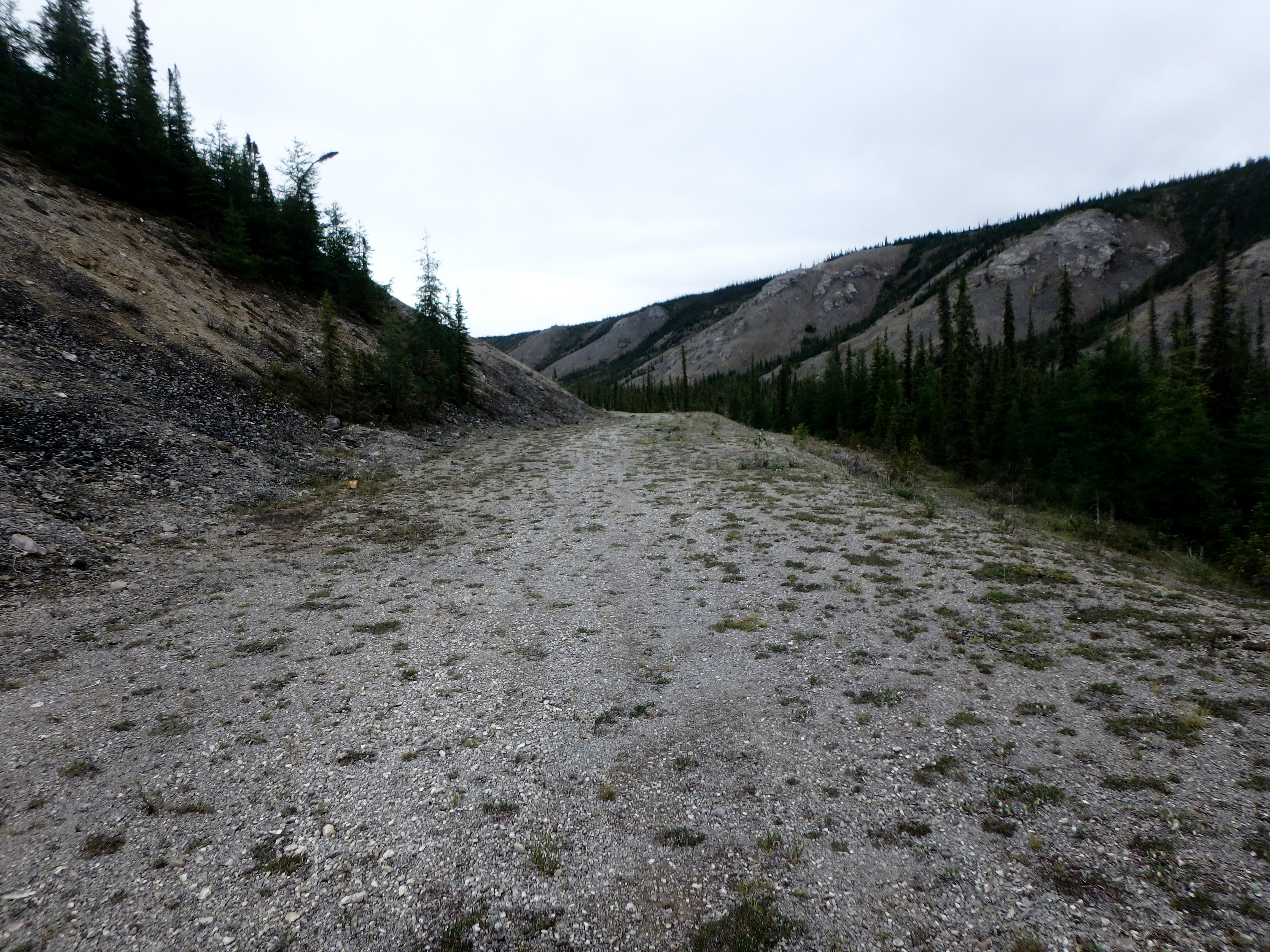
I start hiking at 5:30am and in about ten minutes come to many old buildings, trucks and barrels. The road turns left up into a valley toward the Plains of Abraham. The trail is often washed out and then reappears. There is some rock slogging, but often the trail is there and it’s always easier than off trail. The way slopes upward as it passes through valley after valley, following the stream. At 7:33, I come across an abandoned bike that obviously broke down on its bikepacking owner and was left behind. At 8:13, I notice a “wind fog” coming up from the below valley. It seems a wind current is pushing a thick spear of fog up the valley. It’s moving quickly. I pass stones in the ground that say “US” and have an arrow pointing ahead. By 8:34, the “wind fog” has stopped following me, meandering off down a side valley. A very interesting phenomenon.
At 10:19 I pass a beautiful waterfall at the top of this series of valleys and come onto a plateau, which must be the Plains of Abraham. It has been a long climb. I take a break, then continue hiking. Soon, it becomes clear that the valleys were just the start of the climb. The trail meanders onward and upward as far as I can see. I set up a determined pace.
My right foot steps wrong on a rock and I have a shooting pain all along the arch on the bottom. I throw myself down, clutching the screaming foot. I massage a big knot that has formed and utter a few words. I relax and massage the foot more, and then I gingerly get back on it. I can feel the knot, but otherwise I feel fine.
I continue trudging, slow and steady. After two false summits, I am now head down, pushing each step through willpower alone, eying the next summit furtively. Is it also false? A false summit is when you look up and see the end, the top, of the climb. When you get there, another section going up with another apparent summit shows up.
I pass this next false summit and find another summit ahead. There is a spectacular bowl carved into the mountain. I continue laboring upward. I hear a buzzing, and soon the helicopter I have seen previously thrums by me over the mountain. I wave. Have they seen me? I keep willing each step and finally, at 1:03, I am at the top and can see the trail start back down the other side. This is the longest climb I have ever done in my life. I sit down for lunch, take off my trail runners and socks to air out my feet, take out the tent and rainfly and spread them to dry. Wow! A hell of a climb. This climb kicked my butt.
I guess I’m glad I didn’t know how far it was before I started. After lunch, I start down. I get to a series of switchbacks, and say, “Why not?” I cut to the right straight down the hill to cheat my way to the next leg. I’m going over hard tundra and some rocky areas, making reasonable time, and I successfully make it to the next leg. I consider cutting again, but below this second leg there are pine trees and what might very well by boggy tundra, so I continue on the normal path.
I see what I think is the next leg cutting down a quarter mile below. It’s a line of rocks that looks man-made. The trail abruptly ends, and I see rock scree obliteration all over the area ahead. But I can see the trail I saw before, so I start down cross-country. After 1000 feet, I decide I better check my GPS. Oops. The trail is back above me. It actually V’d back where I’d left it. There was no washout. Either I wasn’t paying attention (yes, happened before) or the V turn was obscured by brush. I start back up and rejoin the trail. I follow it dutifully and arrive at Andy Creek.
I fill up with water, treating it with Aquamira. This spot is easy. Remains of a bridge directly ahead and the trail can be seen straight back to where it cuts to the left and starts up a hill. I head up the trail, feeling tired after all that climbing. I’m rewarded with more climbing and a turn into another valley. I’m still leg tired, and I get to enjoy yet another climb. I manage it all, including getting lost again, and come out next to the Carcajou, which I camp at after about a mile, at 7:30pm.

I’m tired, but I’ve also managed another 20+ day. After relaxing, I’m out of the tent looking around at 9:32 and I notice some creature down the trail a hundred feet away, sitting, looking at me. It is freaky. First thing that comes to my mind is the movie, “The Village.” I can’t tell what it is, but, it is watching me. I grab the air horn and sound a blast. The creature starts, but then settles back to watching me. I throw a big rock in its direction, and it decides to trundle off. I’m not sure, but I think maybe it’s a porcupine.
I decide I need a fire to warn animals and light a small one.
Day 6: Tuesday, July 31, To where the Trail Starts Away from Trout Creek, Mile 120.5 (25.5 miles)
I wake up around 4:00 and notice a beautiful view of the moon over the mountains, across the valley. A fantastic sight. I’m packed and ready to go at 4:47. I head out along the Carcajou, fording at the turn to Bolstead Creek Valley. Crossing the Carcajou is much easier here than on day one since the water volume this far upstream is much less. Around 9:30 I see ice on Bolstead Creek in the distance and I break off trail to check it out. The ground is squishy tundra. The ice is beautiful, with an internal blue glow. I cut across the tundra toward a point farther down the trail, cutting off some time, probably. The Tundra is slower and I’ve maybe shaved off a quarter mile.
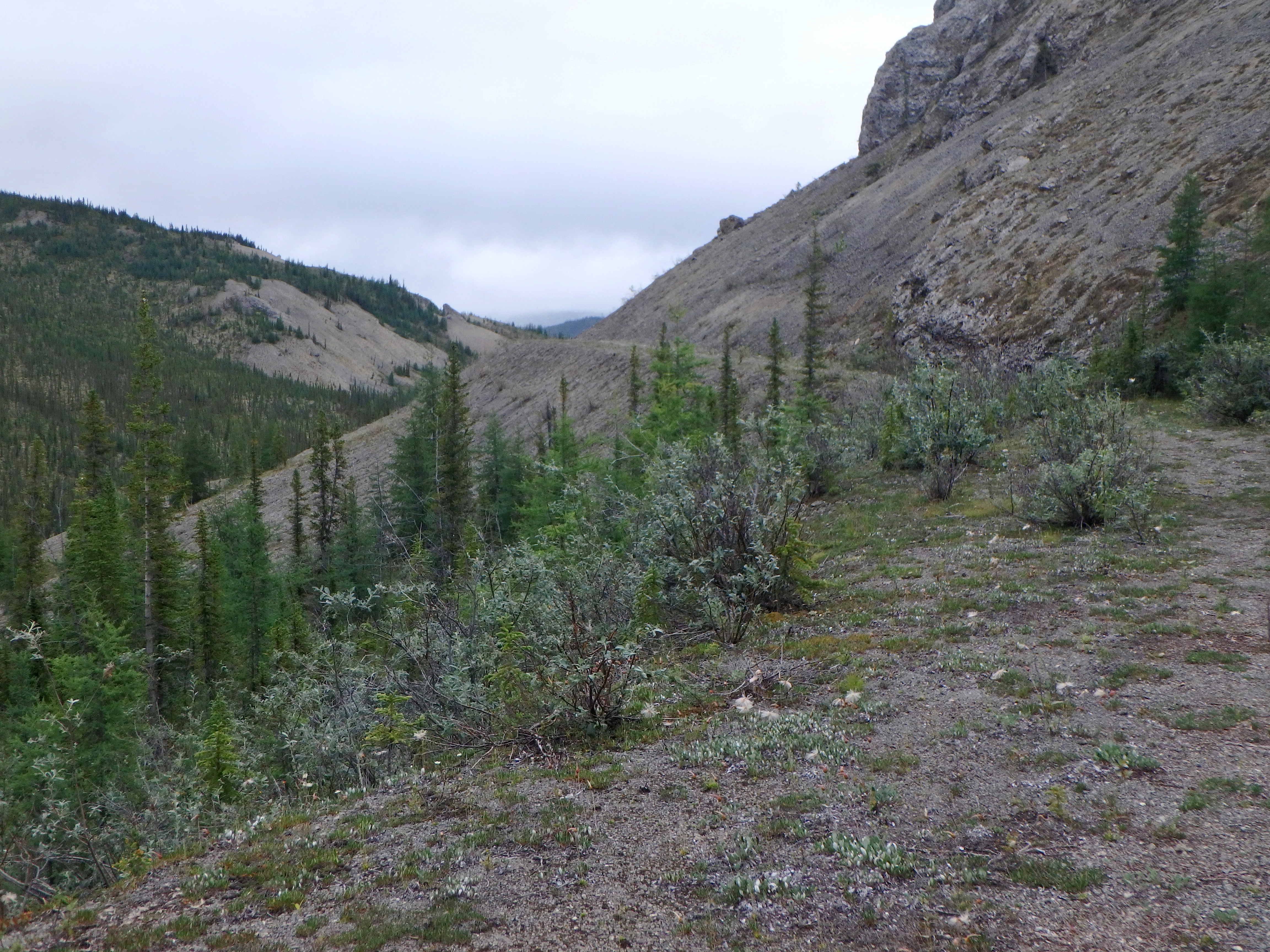
A little later I spot a lone moose, who sees me. He warily skirts my path, watching me closely. I’m still headed up the Bolstead Creek Valley, and the helicopter passes by again. I get to the pump house and can hear some machinery running, but I don’t see anyone. I turn right through Devil’s Pass and manage past several trail washouts. I see the trail on the other side of what is another upward sloping valley and cross over to it.
I’m slowly ascending the trail and look over to the right, and there is the trail, too! I need to look at my maps more often. This is where two options exist, a higher trail I’m on, or the primary Canol Road trail on the other side. The primary looks pristine and I consider trekking down and back up to it, but decide I’m already here, I’ll just stay. As I traverse the trail, it is clearly higher than the other. I start to hit many washouts and the other trail mocks me with its apparent perfection. I curse the other trail and slog onward through countless washouts and overgrown sections. Down the other side and it gets difficult to follow the overgrown trail, but I’m watching closely. When I’m maybe a quarter mile away from the other trail, near the end of this side, I cut across the brush and tundra to get to the primary trail.
At 5:00pm, I pass an abandoned full-size machete, and shortly thereafter, I pass into Trout Creek Valley. The first three miles have the trail on the left of the creek, and it is washed out repeatedly. I keep searching for, and finding, trail continuations. I think I would probably be better off just hiking the rocks and ignoring the sections of trail, but I can’t resist the lure of the easier path. I classify Trout Creek as the third most difficult hiking area, the first having been Dodo Canyon and the second having been the six miles along the Little Keele River Valley.
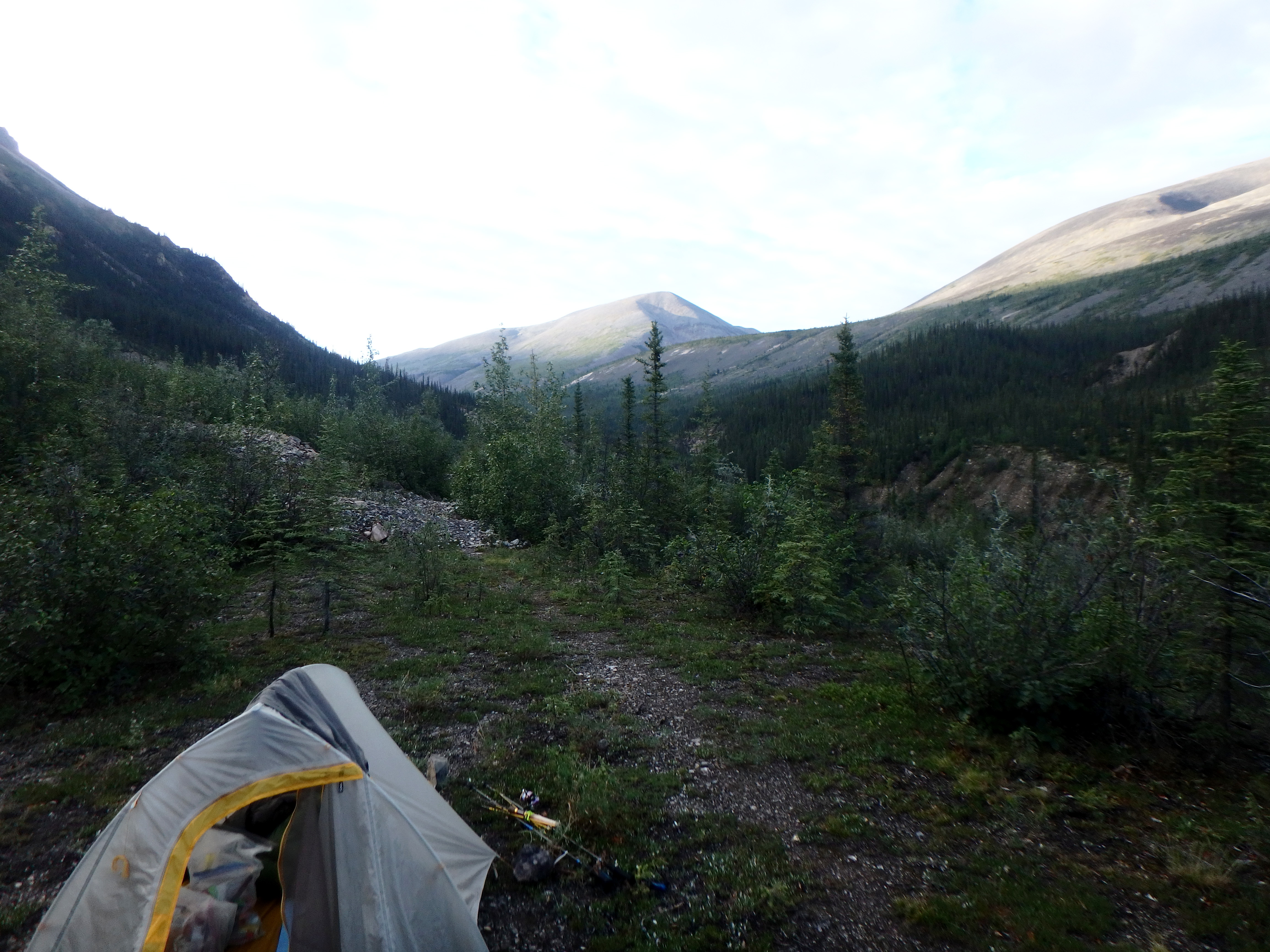
I pass the first major incoming tributary from the east, and I see on the paper map the trail changes to the other side. Scanning across the creek, I see the trail. This part of the trail is very easy to traverse, except it is completely washed out at four or five spots, where the trail is perhaps fifty feet up the slope and the entire side of the mountain is gone. Sometimes I go up and over, and sometimes down and back up. I keep going until the trail appears to veer farther away from the creek, matching what I see on the map. I hope I’m past all the washouts to give me a nice start in the morning (and I am). I make camp at 8:15. I have more in me, but I’m tired enough, and decide it is time to call it a day.
I spend a typical evening to morning.
I complete the camp tasks. I fill up on water to 2.7L in two one-liter bottles and one 700ml bottle, and treat them with Aquamira. I put up the tent, put in the mat, blow up the pillow. I pull the miscellaneous Ziplock and titanium cup out of the clothes stuff sack and pack the remainder (clothes) as a second tier to the pillow. I put the seat and sleeping quilt in place. I arrange all the things including food and pack to the left of where I sleep. Bear spray and horn to the side of the pillow. I get out the Body Glide and put it at the front of the tent ready for my feet when I put on the trail runners in the morning.
I look around and marvel at the beauty. I collect wood and start a fire, burning cigarette pack cardboard and butts. I eat dinner, drink water and brush my teeth. Then, I’m bored, smoking to pass the time. I let my mind wander. Thinking of nothing. Thinking of whatever. I decide to charge the 700ml with Propel for the next day, then eat some nuts. The mixed nuts aren’t part of a meal, they are for eating at night to store reserve energy. I lie down in the tent, relaxing. I get out of the tent and look around. I pee, look at the view, breath in the air. I think about the fact I’m far away from humanity, and I enjoy that. I revel in the fact I’m on my own and there is nobody for many miles.
I take out the maps and think about the next day’s hiking. I enjoy reviewing the maps, always. It’s around 11:30 and still light. I lie down in the tent and try to sleep, occasionally waking up to have a cigarette. It never truly gets dark, but reaches a state of twilight from around 1:00 to 4:00. I drink water occasionally. I’ll be happy to get started again tomorrow when it gets to around to 4:15.
I wake up and pull on my pants. I drink a cold instant coffee and smoke two cigarettes, sitting cross-legged in the tent with the quilt around me. I pack up. First, I throw the full but not closed stuff sacks, the food bags, pack, bear spray and water bottles outside the tent. I put Body Glide on my feet and pull on socks. I put my trail runners on. I get out of the tent and throw the sleeping mat on the pile. I take down the tent and pack both the tent and rain fly in their bag, which I put into the bottom of the pack. I put the stake bag into the pack back mesh pocket and the pole bag in the left side mesh pocket. I compress and form the sleeping bag and miscellaneous stuff into rectangular pancakes and put them in the pack on top of the tent. Next goes the mixed nut bag, food bags, trash bag and cigarette ziplock. Then I close up the pack and put the water bottles into the side mesh pockets. Maps in baggie go under the tent pole bag in the side mesh pocket. Fishing pole and seat go into the back mesh. I strap the bedroll on the pack top.
I put on my Buff and hat. I have a reward cigarette for getting it all done, and stop and enjoy being all packed up and ready to go. I wonder what challenges and sights I will encounter today.
Day 7: Wednesday, Aug 1, To the Godlin River, Mile 147 (26.5 miles)
I’m packed up and on the trail at 4:48. It rained overnight, and much of this morning’s hiking is through good trail, but that has enough overgrowth that I constantly brush wet foliage, keeping my legs and arms soaked and cold. I’m hiking through a long tunnel in the encroaching brush, but it’s well delineated. After fifty-three minutes of hiking, I come out of the foliage looking up a small valley where it looks like the trail is washed out.
I realize my ball cap is no longer on my head. It must have been snagged by a tree branch. I’ve had that hat for a lot of backpacking and I consider going back to search for it, but it’s just a hat. I take a too early cigarette break while treating some water. While sitting there, I consult the GPS and paper maps. I’m seeing a V shape. I look across this small valley, and, right there, the trail is obvious and heads back down the other side of the valley. Good thing I was “bad” and gave myself an early cigarette break or I would have made the same mistake again of assuming the road continued up a washed-out valley. I would have been backtracking again.
I go to put my pack back on, and, on the ground next to it, is my ball cap. It must have been traveling on the top of the pack after it got snagged off. I hike with speed to try to keep my body temperature up, but I’m very cold. The sun peeks through a hole in the clouds and I stand in the light to warm up a little. It’s enough to stop the shivering, so I decide not to stop and light a fire. I’m more careful to avoid wet branches, or to knock the water off foliage with my trekking pole before I hit it.
I come across another porcupine on the trail. As I get close, he turns and trundles down the path, finally turning off so I can pass. Twelve minutes later, I come across another broken and abandoned bicycle. Other than being wet and cold, the hiking is good, and I reach the Twitya at 9:07.
There is a ripped blue raft, abandoned. Looking upstream, I see where a side braid comes back to the main river. I head up through the woods and across some thigh-high standing water to a spot about 300 yards up, just past the braid intersection. I cross with the water never going higher than the top of my thighs. I then traverse the braid coming into the main river, and finally the section past that, which is separated into two parts.
Very lucky day! The Twitya is the most difficult river of the Canol, and I’ve gotten across without swimming. I pull out my down jacket and put it on to warm up before I continue. I’m upstream, so I go up the ten-foot dirt bank and head through the tundra and trees downstream to try to find the trail. I find a fallen telephone pole and head away from the river seeing if this is the trail. It’s not.
I continue farther and there is no sign of the trail, so I head back to the point that seems most opposite the end of the trail on the other side of the river, where I can see, faintly, the ripped blue raft. I find the telephone pole again and also what looks like a manmade stream bed with a rock berm on both sides and I follow it for a while. It’s overgrown, and I finally decide it will not turn into the trail.
I consult the GPS and angle back towards where it shows the white track trail, and I find it. It has taken about twenty-five minutes to locate the trail this time. I realize I should simply have headed straight up the hill from my crossing point and I would have quickly run into the trail.
The trail allows some good miles today. There are still the occasional trail washouts, bogs and also three ponds in a row that obliterate the trail. After the three ponds, I come upon a place where there are two pristine trailers directly in the middle of the trail. This must be some remediation equipment. The one trailer is a flatbed and has a red four-wheeler strapped to it. Since there is nobody around, I jump up on the trailer and get on the four-wheeler. It feels good, comforting, to sit on a piece of civilization. Perhaps I need to get one for myself and try some four-wheeling. I take a picture of me on this thing, as I fantasize about traversing the trail with a motor under me.
The trail is washed out in several places along the Godlin River, and I’ve been lost, and found again. The trail disappears again and I’m following someone’s path that pops out at the bank of the river. I’m tired and there is a small spot next to the river that looks just OK for a tent, so I stop for the night. I’m pleased to have made some progress against the mileage deficit remaining from the Little Keele delay.
I have brought one luxurious Mountain House meal of chicken and dumplings, and I boil water on the fire and enjoy the meal.
I wake up at 1:30am with a little panic, realizing I am currently lost. What if I can’t find the trail again? I look up the river as I calm myself with a future day cup of cold coffee and three cigarettes. I know I’ve always found myself before, and I know in the morning I will go up 300 yards to the unwashed-out bank section, turn into the scrub and trees and climb up the mountainside and will find the trail. I’m never in a real panic, just feeling the potential. I feel the full weight of how many times I’ve been lost and had to find the trail again. I am cognizant that there are probably no people within many miles of me, and I’m OK with that. It is part of why I came here. I make a mental note to never camp without knowing where the trail is. Pulling my down quilt up, I bask in the cozy warmth and fall back asleep again.
Day 8: Thursday, Aug 2, To Canol Outfitters, Mile 167.5 (20.5 miles)
I get ready in the morning as usual. I head up the river about 300 yards to where the bank is no longer washed out, turn right up the mountain and find the trail, as I knew I would. Today and three more days, and I plan to find myself at the end at mile 222. I changed to the second camera battery yesterday, so that should be good for the duration. I have about 40% charge left on the Garmin inReach Explorer and enough cigarettes for these four days. I am confident.
At 6:36 two large birds fly by and perch in trees. I’m not sure if they are Golden Eagles or Falcons. At 7:00, I come across another porcupine on the trail, and I follow him down the trail. He lumbers along slowly, right in my way. I get as close as twenty feet behind him and say out loud, “Out of the way, Peck!” (A quote from the movie Willow.) After about one-hundred yards, he finally veers off the trail and I can get back to my usual pace. At 9:30 I come upon a log lean-to frame. I wonder what it’s for. The trails seems to be better delineated here, with frequent tire tracks.

At exactly 12:15, I take a picture with the camera, and it makes half a shutter click and goes dark and unresponsive. I put the camera away. In a little while, I hear it make a sound and pull it out. It says, “Battery Empty.” I just put this battery in yesterday afternoon, and the first had lasted through most of seven days. I didn’t think anything could possibly happen for me to decide not to finish, but, I immediately realize that without the camera, I don’t care about finishing. The last sixty is the easiest sixty. I decide the 160-mile point will be the end.
I already know I handle well being totally self-sufficient, far from the bulk of humanity, so I don’t need to prove that to myself anymore. As I continue to hike, I’m irritated I cannot take pictures. At an amazingly orange stream that particularly catches my fancy, I utter a nasty word because I want a picture. I try the camera and it comes on. It seems it had enough juice left to give me this one picture. If I let the battery sit, perhaps I can get another picture when the plane comes to extract me. The first battery probably also has enough residual charge to get a couple more pictures.
I text back home on the inReach about the problem and that I’m getting out at 160, and I text North-Wright Air that I want extraction at mile 160 instead of 222. I ask if they can come tomorrow. I make it to the larger of the Godlin lakes, waiting for North-Wright to confirm when and where they will extract me. I heard there is an outfitter in the Godlin lakes area. There is an airstrip below the smaller southern lake on the map, marked “Condition Unknown.” I’m not sure if that will be the extraction point or not.
I slowly make my way down the trail next to the lakes, taking extra cigarette breaks, since I don’t have far to go, nor do I know where to go. Now I have plenty of cigarettes to be a complete glutton. I carefully look over both lakes as I pass, looking for some kind of lodge or people.
After passing the second lake, I’m wondering if there really isn’t any camp out here. Since I’ve received no response about a pickup time or place, I decide to check out the airstrip a little farther south.
I hike on, and soon I see buildings in the distance. I pass some trees and shrubs and come to an opening to the building area. There is a fire pit with some meat turning on an electrically powered rotisserie. There are a slew of buildings and a big picnic table with people sitting at it. They notice me, some random guy that just appeared from nowhere. Three people walk over to talk. I say, “There are humans here.” It is a strange feeling to come upon people after being removed from civilization for a week.
They ask where I came from. “I walked from the Mackenzie River at Norman Wells,” I reply. I’m told this place is Canol Outfitters, and they run hunting expeditions from this base during the warmer months. One of the three is Glen, the co-owner, with his wife Glenda. Glen and Glenda. I’m bad with names, but these will stick. One is Lee, the helicopter pilot. I don’t remember the third person’s name, maybe it is Ken.
I ask, “Do you have a room… and shower, available?”
“Yes, not a problem.”
Glen shows me to a shack. I’m in a daze going from all alone, nobody for one-hundred miles, to a comfy hunting camp. I’ve completed 167.5 miles solo. I’ve found out what I can do and I’ve confirmed my mental fortitude. I’m going to get a shower and my adventure is coming to a close. It’s a warm feeling.
Without the camera, I still have little interest in slogging the last sixty miles. I take a shower. It cleanses off the trail, well, most of it. I head to the picnic table, the gathering area. There is a game of badminton going on, two on each side. They are having a tournament. I sit at the table and say hi to everyone. There are several hunters who have completed their Dall sheep hunts. They look familiar. How strange is that? I mention it to the one guy and he says he feels the same. I realize they are the hunters I saw at North-Wright Air when I was arranging my 222 extraction. We all realize the connection and are enthusiastic to see each other again and find out what each other has been doing.
I’m asked about my hiking experience and tell them about it. I meet the cook. She is a young, attractive woman married to one of the hunting guides. My (now defunct) idea of a hunting camp cook is an old salty guy that knows how to roast meat and warm up some beans. Between the owners, staff, guides and hunters, there are maybe ten people.
This is a place of unapologetic hunting men. Unapologetic about being confident men. Unapologetic about pursuing and killing animals for sport and food. Unapologetic about being themselves. They have a bottle of whiskey on the table. I’m chatting with the hunters and one asks where I spent last night. As we talk, it turns out that they had four-wheeled the trail yesterday and stayed overnight at the pole structure lean-to. We were camped less than ten miles from each other.
Lee heads to the helicopter. There are two parties of hunters out on their ten-day hunts. One has just successfully killed a Dall sheep on the eighth day of his hunt, and Lee is flying out to get him and his guide. A while later, the helicopter returns, and everyone heads to the landing zone. Glen drives a four-wheeler with a trailer. The trailer is for carrying the men’s gear and the sheep skin, head/horns and meat. I watch from a distance as a tall man in neutral pants and a camo shirt gets out of the helicopter. Everyone shakes his hand in congratulation.
The hunter walks toward the picnic table with a look of pride on his face. I say hi, tell him my name and shake his hand. He says his name is Mark and that he bagged a Dall sheep. He tells me he shot it at 640 yards. Since I was on my college pistol and rifle teams and was in the Army, I am fully impressed by the range. I ask him how much his rifle weighs (For me, as a backpacker, weight is everything. Hunters I talked to earlier told me they carry lightweight rifles of four to five pounds). Mark says his rifle is ten pounds and he lets me hold it. “Wow, that’s heavy,” I say. He says he needs the extra weight for stability when shooting at long distances.
At the table, we’re all talking, and Mark explains he gave the sheep two warning shots. His first was high and the second was slightly in front. Then he had the windage correct and brought the third shot home. Mark is like a returning god in my eyes. Plus, he’s a very nice person. He talks about a woman he met that had “PETA” on the front of her shirt, which concerned him. Then he saw the back, which said “People Eating Tasty Animals,” so he decided she was all right.
I’m told by the group that Dall sheep hunting is the most difficult and rewarding. You must stalk them over steep, rocky mountains. I’m sure I want to try it someday. It takes a little effort, but I slowly work out what the total cost of guide, helicopter, lodging and sheep tag is. It is not a sport for the poor. It is twice what I spent getting my private pilot license. It is the cost of a small car. I’ll try to figure out a way, because from what I can tell, it would be an experience of a lifetime.
Dinner is the meat from a Dall sheep one of the hunters shot yesterday, accompanied by a large amount of delicious potato salad and broccoli salad. The sheep meat “shall not be called mutton,” I’m told. This meat has as much in common with back-in-the-world mutton as an orange has with a block of wood. It has no gaminess and is flavorful, and so tender, much of it simply melts in the mouth.
Ken, sitting next to me, says he can’t finish his and gives me the big piece he has left. I know they’ve been assessing what kind of man I am, so I close the deal by saying thanks, and forking the entire giant piece into my mouth at one time. I’ve always enjoyed impressing people with just how much I can ram in my mouth at one shot and eat it. I get some nice looks over this. Little do I know I’m already accepted into the man club for how far I hiked to get here.
The helicopter heads back out to get the remaining hunting party. It returns with a man and son, both bowhunters. They each shot a Dall sheep and the man also a caribou. They tell me of many other hunts they have been on.
Later, I’m having trouble sleeping. At around 12:00 (when it starts to get a little darker) I step out on the shack threshold to smoke. The bowhunter’s guide walks by and sees me, asking “Are you the Canol Trail backpacker from Indiana?”
“Yes,” I reply.
He asks for a cigarette, and we exchange stories of my hiking and of his guiding the two bowhunters. Three cigarettes later, I give him one of my, now extra, packs. He is an extremely likable person, as is everyone I’ve met here.
Guess what? At 4:30, shortly after arriving, I tried my camera to see if I could get another picture, and I took four. I was surprised and happy to get a few out of the dead battery. At 6:00, I tried again and happily got one of the picnic table area and one of the inside of the shack. At 8:00, I tried again, and took five pictures, noticing that the battery indicator icon showed something between half and full. It appears the battery is far from dead after all. I’m not sure what I’m going to do with this yet. (Note – the camera charge port is special, so, there was no way to charge it at Canol Outfitters.)
Day 9: Friday, Aug 3, To Caribou Pass, Mile 192.5 (25.0 miles)
At 5:00am I’m up and out smoking again, and the two dogs who seemed happy with me last night are now suspicious and start a little barking. Ken emerges from the next over shack in his shorts with a rifle, asking the dogs what the hell is up. He sees me and asks, “Were they just barking at you?”
I say, “Yes, I think so.” He mutters something about stupid dogs and heads back into his shack. This is what real men do. When something might be wrong, they go directly to confront it. They don’t cower behind walls.
I decide to go fishing. I prep up my pole and head down the grass runway toward the lower Godlin Lake maybe a half mile away. I take my camera since I’m pretty sure it has fixed itself, and I take some pictures and it seems good to go. There’s probably a better way, but I slog through tundra and boggy marsh and arrive at the lake edge, thigh high in water. Casting out with the spinner twenty to thirty times yields no strikes. I head back, slogging the bog. I’m still thinking about the camera working, but since I probably already have North-Wright coming to get me this morning, it doesn’t feel like I should try to change plans.
I head over to the front building where they cook and serve breakfast and go in where the cook and Glenda are prepping breakfast. They tell me the coffee will be ready soon. After I tell her of my fishing experience at the lake, Glenda tells me if I followed the trail back, I could have fished at the lake without slogging. I say my legs needed exercise anyway. I also mention to her that I think my camera is working again. I sit in one of the chairs in this cozy room, heated by the log-fired stove from one of the original road construction buildings. There is a very interesting book on the history of hunting outfitters in the NWT, which I absorb.
Others arrive, and we have an excellent all you can eat breakfast burritos and orange slices meal. I tell Glen about the camera. The weather is not looking good, so I ask if he thinks North-Wright is flying today. The answer is no. My pulse quickens, and I look at Glen and say maybe I could keep going on the trail since my camera is working. He doesn’t say it’s a bad idea, so, now I’m getting excited. I ask him if he has a micro USB charger for my Garmin inReach and he does, and he hooks it up to charge.
I tell him I’ve decided to finish the trail. Does he have five to seven Cliff bars? I scarfed all my extra Snickers and some Clif bars when I thought I was finished with the trail. He says he does. I head off and pack up to leave. I go to the guide shack, and the guys are up on the raised platform across the way and yell over to me, “Nobody’s in there.” It’s too far to tell, so I ask if the one guy is the person I gave the extra pack of cigarettes to, and it is.
“I’m sorry, if you haven’t finished the pack of cigarettes I gave you, can I have it back?” I ask.
“Yes, no problem. It’s on the table next to the bed on the far left.”
I finish packing up and head back to the front building. Glen hands me a Ziplock with six Clif bars and six candy bars (Snickers and Mars). I didn’t ask for the candy bars, but he knows I scarfed mine and so he added them anyway. I thank him, ask if he has any instant coffee and can I just knock on their door to settle up with Glenda. He says yes and heads off for the coffee. I think I’ve infected Glen with my excitement about getting back on the trail.
I pay Glenda, but I’m C$20 short on cash. She says not to worry about it, it’s enough. I tell her I’ll send the C$20 when I get back to Normal Wells. I give Glenda a big hug and head back to the front building where I find Glen with a baggie of freeze dried coffee. I thank him, shake his hand, and, then unable to help it, I hug him. He has been incredibly kind. He waves at me as I take off down the trail at 10:32am.

The trail is much easier today than on previous days.
I’ve grown to trust only a combination of the paper maps, the GPS red track and the GPS white track. Much of the time, the white track seems accurate, but enough times I’ve noticed I am on the road and the GPS shows me on the red track. Sometimes I am on the road and it shows me not on either the white or red track. The paper maps have confused me because the elevation interval is not enough to show the lesser hills. The map is not equivalent to what I used in the Army, or at least not what I remember. This is certainly very different terrain than what I learned land navigation on thirty-five years ago.
There are some trail washouts and rock-slide areas today, but I navigate past all of them without much trouble. I am much more deliberate now when I come to a trail break. I scan the land ahead like a tracker, looking for signs of passage and where it looks like the trail might go. If the trail is not obliterated too far, I can usually spot the place it starts again. I also look for bike and four-wheeler tracks and footprints. There have been a few boot prints along the way. I imagine someone else using my trail runner tracks as a sign. Hopefully, not for those places where I was lost.
I come to a rock flow where I can’t see the trail continuation on the other side. I scan carefully, and I can make out a slight, but now obvious to me, trail of slightly lighter surface and lightly packed rocks. I follow the track and on the far side of the rocks, it meets up exactly with the trail continuation.
At 5:53pm, I come upon a small creek with an amazing looking hole and decide to fish. I set up my rod, cast to the end of the pool and reel my Panther Martin up the channel. The lure only manages a couple feet before I hook into a big fish. I fight him to the shore. It’s a nice big grayling. I catch three more big ones from the same hole before I’ve finally spooked the remaining fish. What an amazing place to find big fish. I consider back to the much bigger Little Keele River where they were only six to seven inches long. I release all four since there’s no way I’m going to stop this early for the day just to cook fish.

About two miles from Caribou Pass, I hear a gunshot in the distance. A little later I smell a whiff of gunpowder. I soon come up to a short side-trail leading to a small house with a tent pitched in front of it. I approach the house and see a tall, handsome, fit guy with dark hair. I ask him if it’s OK to approach the house and he says, “Why do you ask?” I say I don’t know if it is private property or not. He says, “Nobody owns this land,” as he continues around the back of the house doing something.
There are two other guys who introduce themselves. One is a French man and the other a young Canadian man. The tall guy comes back around the corner and we shake hands. I immediately forget his name, because I suck at remembering names. I notice his quiet confidence. I ask where he’s from, and he says, “I live here.” I hear a baby cry a little and the door to the house opens and I see a young woman changing a baby’s diaper. I figure out finally that he is native.
He asks if I heard a shot and I say yes, and that I smelled the powder smoke, too. He says he shot a caribou. He has to go out and prep it, but first he’s taking wood to a smoking tent where I see maybe six rib racks hanging. They are caribou, already well into the smoking process.
I imagine living his lifestyle, and it has great appeal. Straightforward, and probably much happier than that of rat-race people living in big cities. I say bye to the other two and as I pass the tall guy I say bye and congratulate him on the caribou. Probably not the right thing to say. I feel a little like an intruder.
As I depart, I say back to all three, “Hey, I’m going to camp about a mile further toward Caribou Pass.” I give them a second and then say, “You know, so you can bring me coffee in the morning when you get up.” We all laugh at this absurdity as I walk down the trail toward 222. I set up camp a mile down the road at 9:30pm.
Day 10: Saturday, Aug 4, To the end of the trail, Mile 222 (29.5 miles)
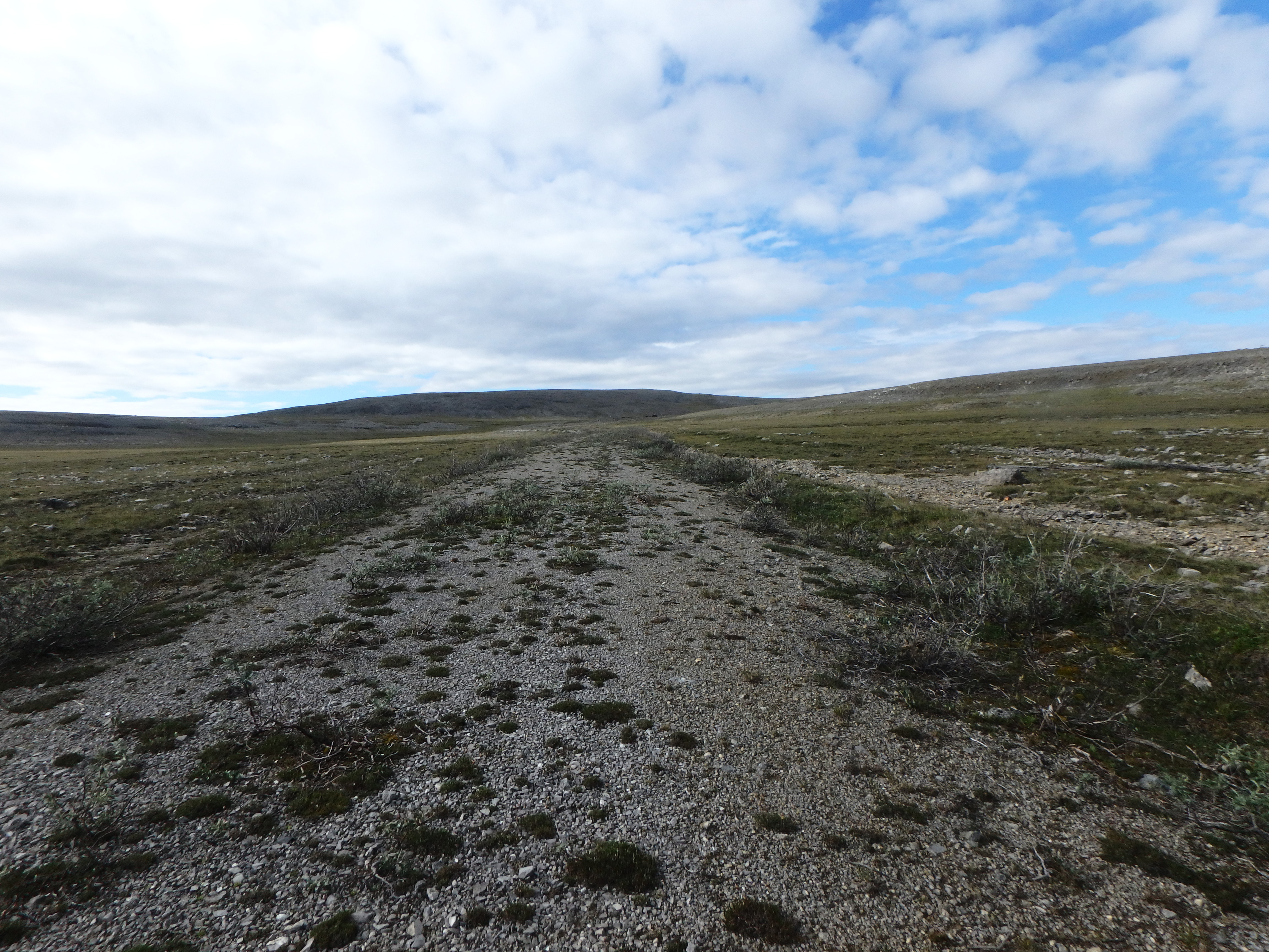
I’m on the trail by 5:00 am. Caribou pass is beautiful. The path today is well delineated with very few washouts. There are some long sections of slight sloping downhill where I am probably getting close to four miles an hour. Some of the trail is monotonously easy.
I’m ten miles from 222, trudging along a nice easy, boring portion of road, when two guys come along in a four-wheeler with a rifle case mounted to the back. Pat and Lee are part of the remediation team and are headed to do repairs around mile 208. In my mind, I’m imagining there must be some sizable city nearby, given the nice condition of the road and finding two guys on a repair stroll in their four-wheeler.
I ask them if they happen to have a cheeseburger, and we laugh a bit about this question I sometimes give non-backpackers I see on a trail. I ask for a ride and immediately say I’m kidding, too close not to finish the rest. I haven’t been seeing much water for the last miles, so I ask about availability to 222. They say there is some just a little way down from here. They also offer me a ride, but back to mile 208. We laugh about that, chat a little more and head our separate ways.
These last ten miles are tediously boring, but there is plenty of time to finish them today. I play a game: See how fast I can hike for the next hour. I put on the speed. Down slopes I am fast, up slight slopes I’m almost as fast. After the hour, I’m winded. I check the GPS. Wow! Four miles. There are only six to go. In four more miles, there is supposed to be a cabin where Glen told me I could sleep.
As a reward for this hike-fast-for-an-hour deal, I get to air my feet, eat and smoke. The hour ends exactly where the excellent road temporarily reverts back to the more overgrown version I’ve seen along much of the way. I wonder why that previous section was so manicured. I’ll probably never know.
After my break, I decide to do another hour, but not pushing it so much. Partway into the hour, I see buildings in the distance. I forget the hour concept and hike steadily toward the buildings, down a valley and through a stream. Back up the other side and I see the buildings are close. Two backpackers who have just left what I see is the back of a large white sign approach me. I ask them if this is mile 222 (I forgot to look for the cabin at 220, this could be it.) and they say yes. I burst into a cheer. I’ve never done 29.5 miles in one day before. Granted, a lot of the day was pristine road. Before the Canol, I’d never done more than twenty-two miles in one day.
I introduce myself. They are two Canadians just starting the trail. They have seen Lee, who’s helicopter is parked ahead. Lee told them they would pass me along the way tomorrow. How coincidental and fun to arrive exactly as they are leaving. I give them some acquired knowledge, caveating that I got lost a lot. I mention Trout Creek being hard. They take my picture at the sign with my camera. They have no insect repellent, and I’ve used only a little of mine, but, after a little thought they decline taking the rest of what I have.
We wave as they head down the trail and I head up to talk to Lee. I’m feeling good. It’s familiar to see him. I ask him to let Glen and Glenda know I made it to the end. He tells me I can camp anywhere while I wait for my ride out.
I text the wife and a couple kids back home that I’ve completed the trail. I text my mountain climbing ex-CFI (Certified Flight Instructor), too. And, I text my backpacking boss for good measure. This has been a more difficult trail than I imagined, and has been commensurately more rewarding. I’m really not sure how I completed it in ten days, especially given how often I was lost and/or delayed along the way. Part of it is perseverance with a 5:00am early start and 7:00-10:00pm late end. If you go steady, and put in a lot of time, you can get to far places.
I set up my tent next to a forty-foot shipping container so it will block the wind. A young man on a bicycle comes riding by and I talk to Ryan about what he is here for and where I came from. He’s part of the remediation team. I tell him completing the trail is a nice birthday present, since I turned fifty-five today. I talk with him for a while. He is extremely likable. We talk about the hunting camp and that it costs a fair amount to shoot a Dall sheep. He says he can just take a canoe into the wild and shoot one anytime he likes. It appears he is native, too.
A little later, I’m in the tent relaxing and reflecting back on the amazing hike, and I hear some people coming up singing “Happy birthday to Greg.” I jump out of the tent and there is Ryan and two women with a birthday cake (half a loaf of cranberry cake) and a candle. They light the candle, and I blow it out making a wish. The ladies are Barb and Stephanie. I thank them for such a wonderful birthday kindness. We tell each other some of our stories.
I’m snoozing in the tent later and a four-wheeler goes past. I wonder just how many people are here at mile 222.
Day 11: Sunday, August 5, Back to Norman Wells
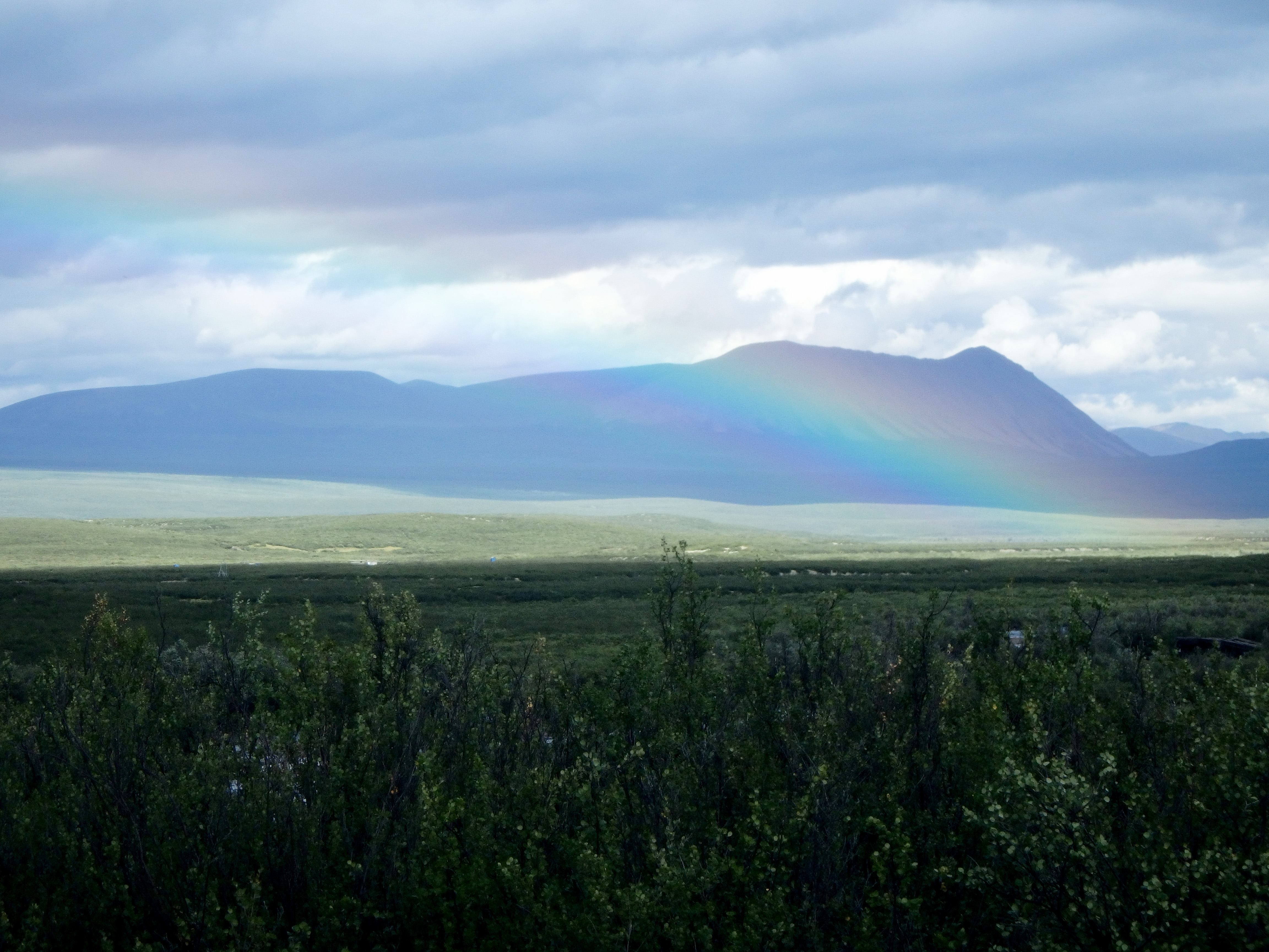
In the morning, I discover the returning four-wheeler last night was Pat and Lee. The current remediation team is four people. I’m not clear what Barb’s role is, and I haven’t met her husband Norman, yet. A blue high-power helicopter flies in and lands. I walk over and say hi to the pilot, Mike. It turns out he is the only one flying a helicopter for remediation work, so he is the one who flew past me four times over the last days. He says he didn’t see me on the trail.
Mike heads out in his helicopter and returns with two trailers hanging from a tether below the aircraft. They are the same trailers I saw on the trail with the red four-wheeler I got on to take my picture. I explain that I did this to Pat and Lee. They don’t mind, and we laugh about it.
I’ve been trying to get a response from North-Wright Air about when they can come get me. I’m already scheduled for tomorrow, August sixth, but maybe they can come early. I love the beauty of this place, but a shower also sounds nice. My daughter Rachel calls them for me and reports back they are closed Sunday. I’m happy to camp another night.
I head over to see if Barb is at home, looking to just chat in general. Her husband Norman is on the front porch soaking a four-wheeler part in gasoline. We introduce ourselves. Barb comes out on the porch and while talking, I discover the young Canadian I met at Caribou pass is their son, Joshua. They also tell me the Dene’s name is Derick, and he lives there with his girlfriend and baby. I also find out the French guy is the one not eating food while hiking the trail to prove it can be done.
A little later, I see four-wheeler Lee, and we chat. He mentions the helicopter will return to Norman Wells at the end of the day, empty, and I can get a ride if I want. We commiserate a little about my having scheduled North-Wright. But who would turn down a helicopter ride? So, I say, “Yes, please.”
Mike takes Pat, Lee, Ryan and Stephanie out to a remediation site where they load big white bags with wire and other old road material. Mike brings back two huge loads on the end of a dangling rope that has a remote release hook, putting them expertly into a material corral. He stops to add more fuel and explains he’ll bring one more load and then unhook the carry strap. He’ll then go get the remediation crew back, refuel and then give me a safety briefing before we fly back to Norman Wells. Later, I’m talking with Pat and Lee, and Mike yells over he’s ready.
I told Mike I’m a private pilot, so he explains exactly what he’s doing as he starts the turbine and takes off. I mention I think maybe he has the most fun job I have ever seen. He’s done a lot to get where he is, and, yes, he thinks his job is awesome. As we fly back, we cross the trail in many places. He points out the site of a helicopter crash and explains, “The pilot made a mistake in turning too sharply with a large load on his skid.” He says everyone walked away, uninjured.
As we fly, I point and say, “There’s where you flew up the valley to that cabin and I was right there.” A little later I mention, “Right there. That’s where you flew over me near the top of my climb on the Plains of Abraham.”
Mike points out the Little Keele River area where I couldn’t find a trail, and from the air, there it is as plain as day. I know I crossed over that on my way to the higher trail, but I don’t remember seeing it. How many sections of nice trail had I missed along the way? I have no idea. I want to find them when I come back next year to take on this beast again. Only, next time, I’m going to take more time, including more fishing and taking in the amazing beauty more. I will cook and eat some grayling, too. Perhaps I can bring something to shoot Ptarmigans with. They do look tasty.
At the airport at Norman Wells, one of the helicopter line guys is nice enough to give me a ride back to Canoe North. When I arrive, Canoe North has space for me in Tent Cabin two, and I move my gear in.
I walk to building two to get a shower. This is a North-Wright Air building that is managed by Canoe North. A pilot named Dylan is there and we chat. After I confirm he is with North-Wright, I tell him they are supposed to pick me up at mile 222 tomorrow. This elicits the confused look I expected. I explain I am the guy for the pick-up, but I got a ride back in the helicopter this evening. Dylan knows the Cessna 206 pilot who is supposed to get me tomorrow and says he’ll tell him.
Dylan explains that, as the Twin Otter floatplane he pilots gets up to speed on take-off, he’ll tilt the plane slightly to lift one pontoon out of the water to further reduce drag. He then just lets the plane take off with slight back pressure on the yoke.
I head back at the main Canoe North building and talk to a group of eight people leaving in the morning with two guides to start their canoe trip. After I tell them about Dylan’s pontoon lift thing, one woman says, “Oh, that’s what he was doing when we took off in the Otter on the way here.”
The Next Few Days
Monday, August 6: I’m at Canoe North. I get a taxi to the grocery store and spend C$331 on candy, cookies, fruit, Sun chips, and a carton of cigarettes. Back at Canoe North, I’m up on the road smoking since there is no smoking allowed on the Canoe North property. People on the porch at the cabin across the street yell over hi, and I head across the street to talk to them. They are North-Wright Air people who live there, and they’ve heard I hiked the Canol. I tell them of the difficulty, and, as with others, they seem surprised that I did the trail in ten days. I’m surprised myself, still. I tell them about Derick, Joshua and the French Guy near Caribou Pass and about the French guy wanting to prove that a person can hike the Canol without eating food. They’ve heard about him and tell me his name is Florian. I talk with them later in the day, too. It turns out the one guy is like me, a private pilot with a little over 100 flight hours. I enjoy talking to them.
Tuesday August 7: Today I move to the Heritage Hotel since Canoe North has two groups coming in and there’s no room available. Fran, one of the Canoe North employees, will also stay overnight at the same hotel since there was not enough room for her either. The Heritage Hotel is very nice, and the food at the restaurant is excellent. I head over to the museum everyone says I should visit. It is as advertised, very interesting. Most importantly, I get a book called “A Guide to the Canol Heritage Trail and Doi T’oh Territorial Park Reserves.” Too heavy to carry on the trail, it describes each major section and comes with detailed, annotated maps – nineteen of the trail to, and a little past, 222, and one for Macmillan Pass, beyond mile 222. It is very interesting to learn from the book that the trail along Dodo Canyon is almost completely washed out, and the trail along Little Keele is marked as dense shrubs, overgrown and washed out. That’s why I couldn’t find these parts of trail.
Yesterday was a holiday, but today, the liquor store opens at 4:00pm. I’m planning to send Glen and Glenda some alcoholic gifts with the C$20 balance I owe. I’ll add some of the treats I got at the store yesterday. Also, I’m sending two packs of cigarettes to the guide from whom I retrieved my pack.
I can walk to the airport, the grocery store or the liquor store easily from the Heritage. I head out and buy a bottle each of whiskey, red wine and white wine. The people in the store give me an empty vodka box to carry them in. On the way back, I pass two different people who see the box I’m carrying and ask where the party will be.
I head to dinner at the restaurant and run into Ryan, Lee and Pat sitting at a table. Since it’s going to rain for some days, they are moving to some other project down south. They’ll be on the same flight to Yellowknife as me on Thursday. We chat a bit and I say bye and move to my table. Stephanie returns to their table and I wave. I hear her say something about “Birthday Boy.”
Wednesday, August 8: I’m out the back of the Heritage having a cigarette and Mike drives up. We’re happy to see each other and we exchange email addresses so I can share pictures of my hike. He’s here to see the others for something. Since it’s raining, I get a taxi to drive me the short distance to North-Wright Air. As I get out with my package for Glen and Glenda, Dennis comes out the door. I tell him I have the package and ask him about the unused flight. He says no problem, they’ll just charge be me a percentage, maybe ten. I tell him to charge me 20% since I feel bad about cancelling. I’ll be back next year and will need another flight and I want their best service. He takes the package to send to Canol Outfitters.
Thursday, August 9: I’m out the back of the Heritage having a cigarette again and Lee comes out with another guy. We chat and he asks me if Mike showed me the helicopter site crash on the way back to Norman Wells, and I say yes. Lee says he was in it when it crashed. He tells me there wasn’t even a single broken finger on anyone.
Pat and Lee are on the same flight to Yellowknife. I’m disappointed to learn Ryan and Stephanie left already, I didn’t get to say goodbye. Pat heads on to Edmonton, but Lee has a couple of hours layover, so we have dinner together at Bullock’s Bistro (excellent Lake Trout). Lee shows me a piece of the crashed helicopter tail rotor he has as a memento in his bag.
Note 1: I had four 1:250,000 maps: 96E, 96D, 106A and 105P. 1:50,000 is much better for land navigation, and that scale is what I used in the military. But you’ll be carrying more maps and the associated extra weight.
Note 2: I fished exclusively with Panther Martin #4 with a brass spoon and black body with yellow spots
